The Defensive Core of Karlobag: Fortica and Sacred Buildings (1714)
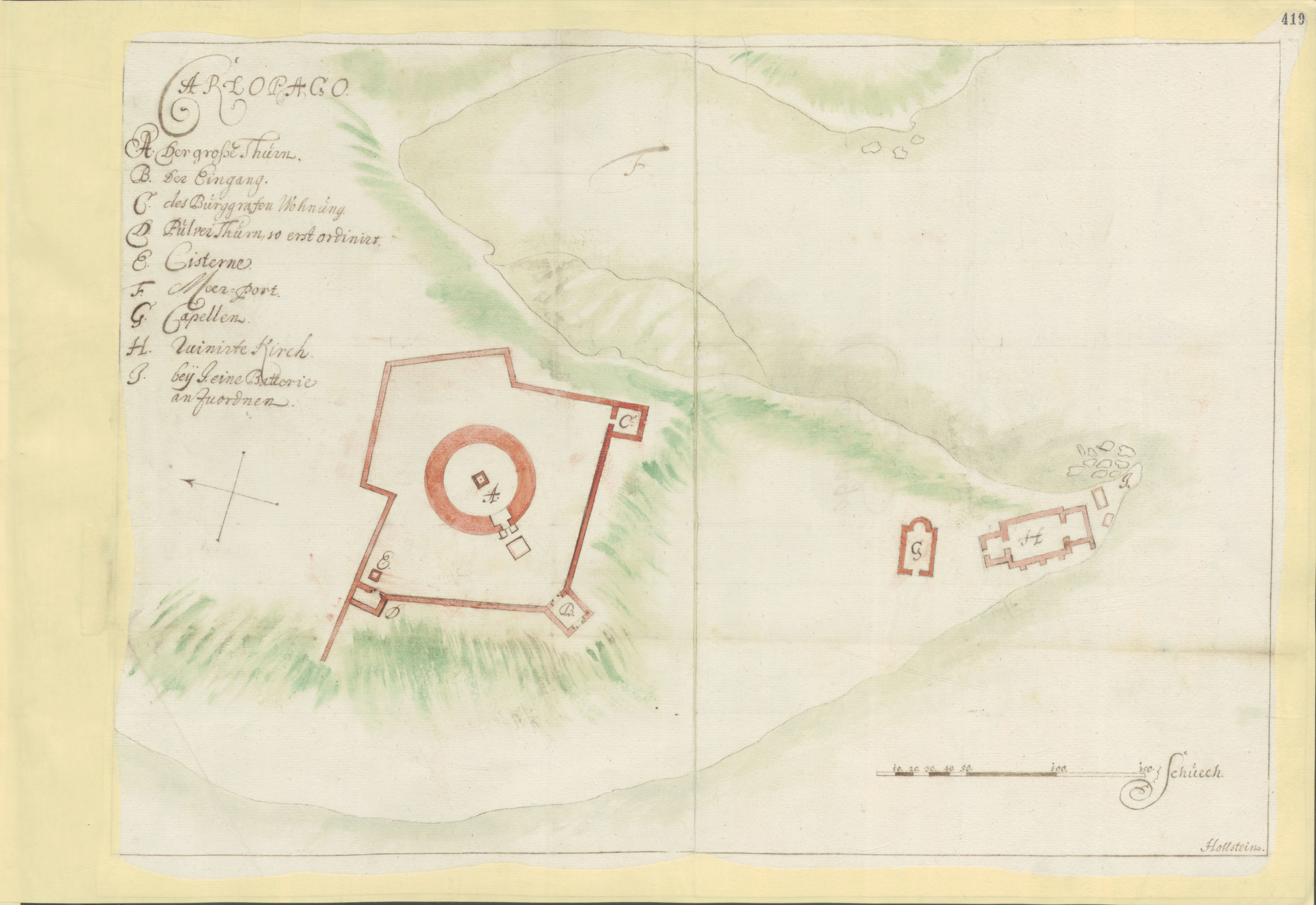
Plan from 1714.
This historical drawing from 1714 focuses on Karlobag’s strategic centre at the time. Rather than depicting the entire settlement, the author documents the main fortress, Fortica, in detail, including its distinctive central circular tower, a key defensive point on this part of the coast.
Show the translation, key and scale
Carlopago – Key to the Labels:
- A: Der große Thurn – Great Tower (the main circular tower within the fortress)
- B: Der Eingang – Entrance
- C: des Burggrafen Wohnung – Castellan’s quarters (residence of the fortress governor)
- D: Pulver Thurn, so erst ordinirt – Powder tower (powder magazine), recently arranged
- E: Cisterne – Cistern (water reservoir)
- F: Meer-port – Sea gate (harbour/landing place)
- G: Capellen (St. Ioannes) – Chapel of St John
- H: Ruinirte Kirch (St. Maria) – Ruined Church of St Mary
- I: beÿ I. eine Batterie anzuordnen – A battery (artillery position) is to be placed at point I
Scale: “Schuech” (feet). As the plan dates from 1714, one Viennese Schuch measured approximately 31.6 cm. The full scale of 150 feet on the drawing corresponds to an actual distance of about 47.4 metres.
A comparison with Martin Stier’s 1660 reconstruction plans shows that the buildings are the Chapel of St John (St. Ioannes) and the Church of St Mary (St. Maria), as confirmed by the inscriptions on the plan itself.
Archival Information
- Institution: The National Archives, London
- Catalogue Reference: MPF 1/352/1