Source: National Archives of the United Kingdom (UK), catalogue reference MPF 1/352/1.
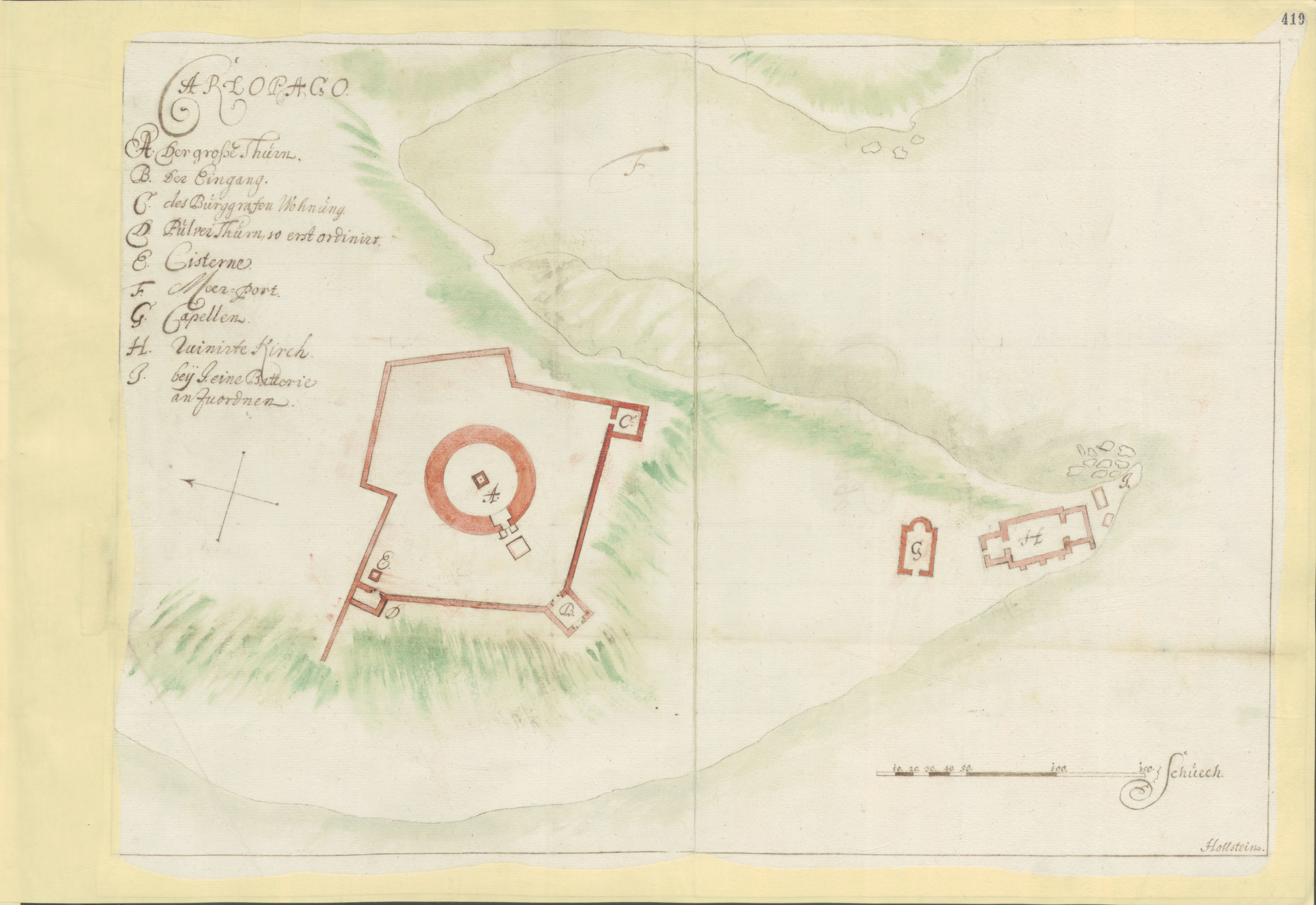
By comparing this plan with the 1660 renovation plans by Martin Stier, it is evident that the buildings in question are the Chapel of St. John (St. Ioannes) and the Church of St. Mary (St. Maria), as confirmed by the inscriptions on the floor plan itself.
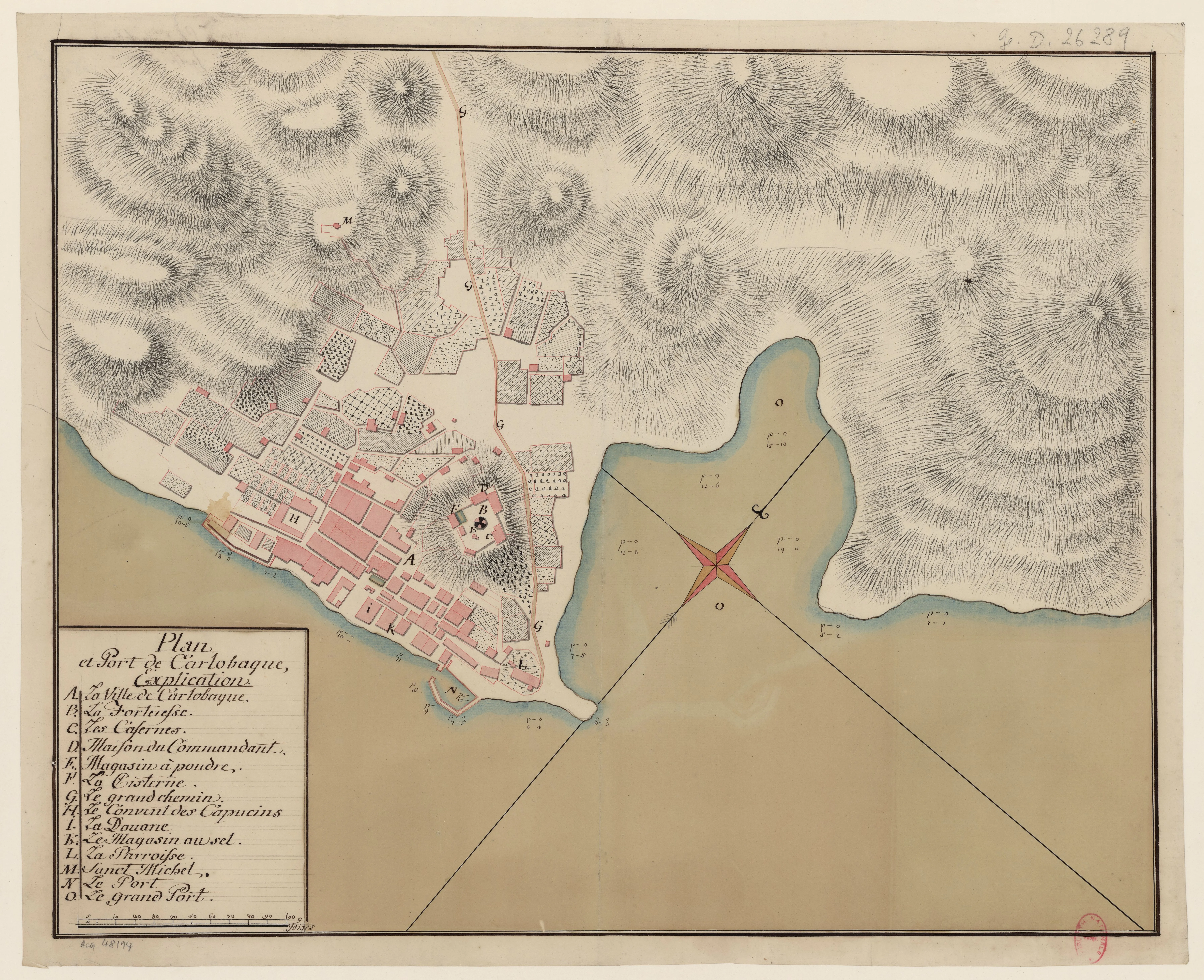
Source: National Library of France (BnF) – Gallica, catalogue reference ark:/12148/btv1b52511603m.
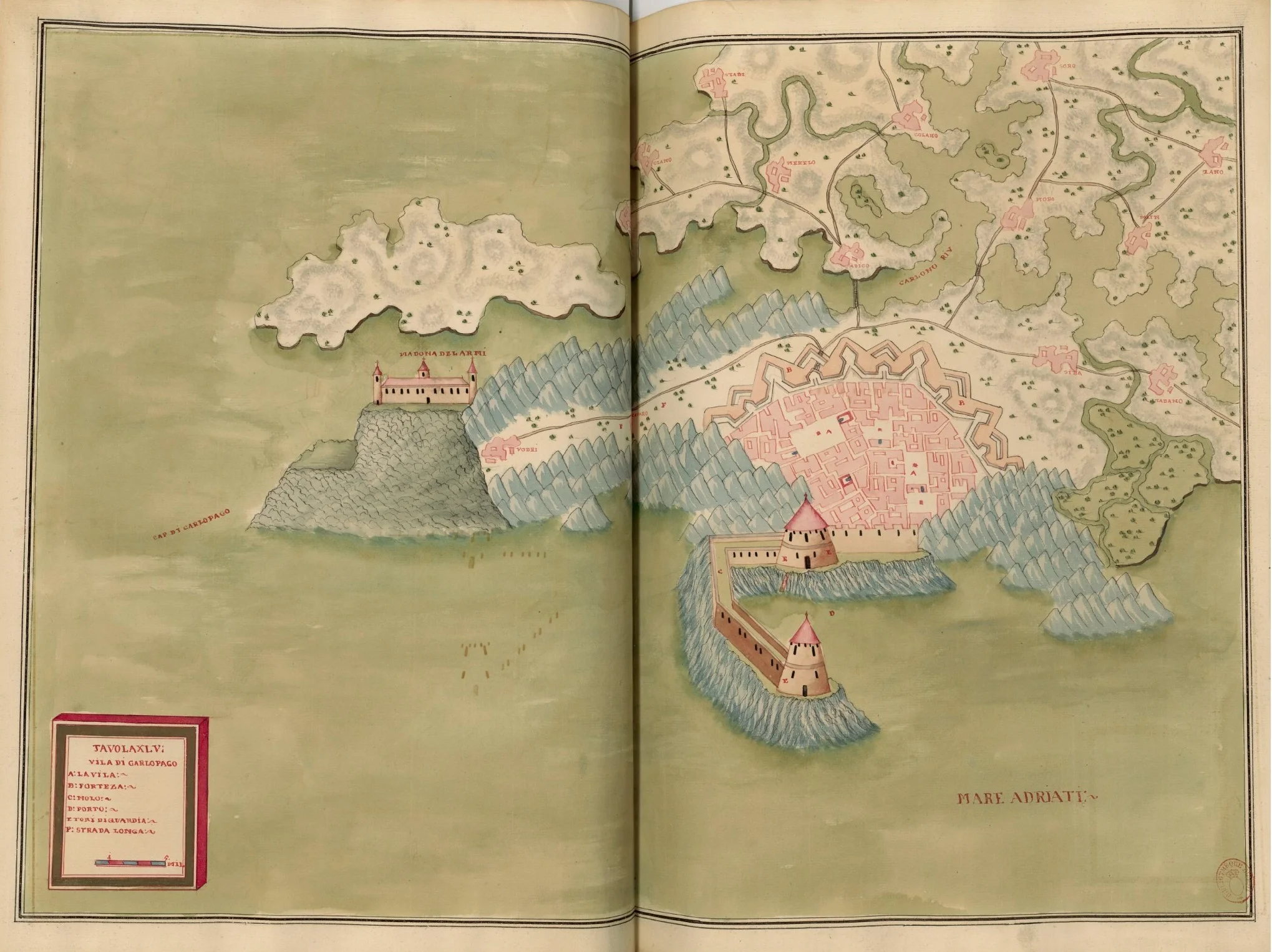
Karlobag as it Never Existed
Comparing De Latto’s plan of Karlobag from 1729 with later military drafts (such as the one from 1757), we come across an incredible discovery. While the 1757 map depicts the real Karlobag at the foot of the rugged Velebit mountain, De Latto offers a vision of the town that more closely resembles a Dutch or Italian lowland fortress.
* Fantastic Walls: Karlobag is drawn with massive, regular star-shaped ramparts that it never actually possessed.
* Geographical Absurdities: Instead of realistic toponyms, the map's index is full of inexplicable names like Soro, Zano, or Itobo, which likely stem from incorrect transcription or phonetic "improvisation."
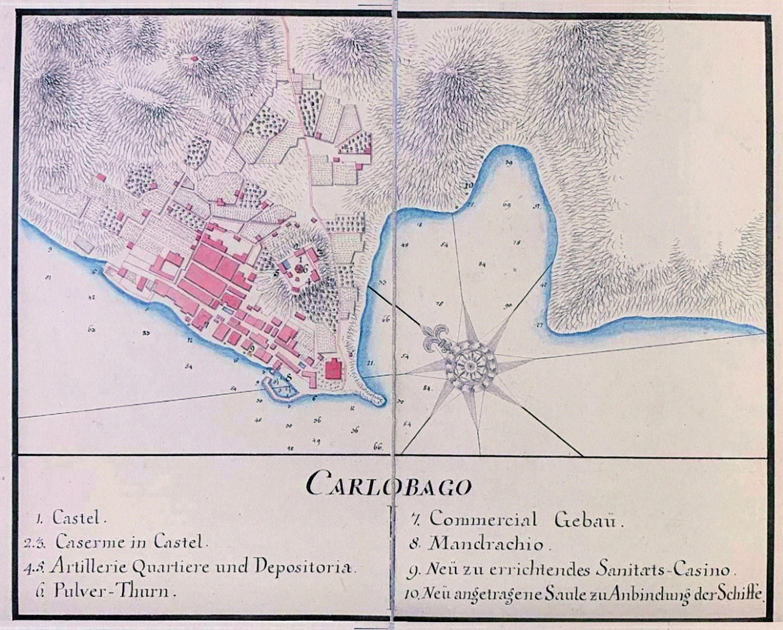
The "Funny Maps" Syndrome: Rijeka, Zadar, Dubrovnik...
Karlobag was not an exception. By analyzing De Latto’s atlas and comparing it with maps of other cities like Rijeka, Zadar, Dubrovnik, or historical Salona, the same pattern emerges. These maps do not show actual topographical positions. Publishers of that era, like De Latto, often worked in their offices in Vienna or Venice, never having set foot on the eastern coast of the Adriatic. To fill their luxury atlases, they used:
1. Outdated templates: Sketches 50 or more years old that were completely irrelevant by the 18th century.
2. Ideal plans: Drawings of what cities were supposed to become according to investors' wishes, rather than what they truly were.
3. Decorative filler: If they did not know what the hinterland looked like, cartographers would simply draw generic hills and fortresses to make the map look richer.
From "Cabinet Imagination" to Science
The true value of De Latto’s 1729 atlas lies not in its accuracy, but in how it shows us how visual information was manipulated for the public of that time. It was only in the mid-18th century, with the arrival of Theresian reforms and precise military engineers, that cartography became the science we know today.
Today, De Latto’s atlas serves as a reminder of a time when a map was more than a navigation tool – it was a prestigious "picture book" that promised order and power where, in reality, there were only stone, sea, and unexplored mountains.
Source: Austrian State Archives in Vienna, catalogue reference AT‑OeStA/KA KPS KS G I h 116‑900.
Source: Austrian State Archives in Vienna, catalogue reference AT‑OeStA/KA KPS KS G I h 116‑901.
Source: National Library of France (BnF) – Gallica, catalogue reference ark:/12148/btv1b53077974w.
Source: Austrian State Archives in Vienna.
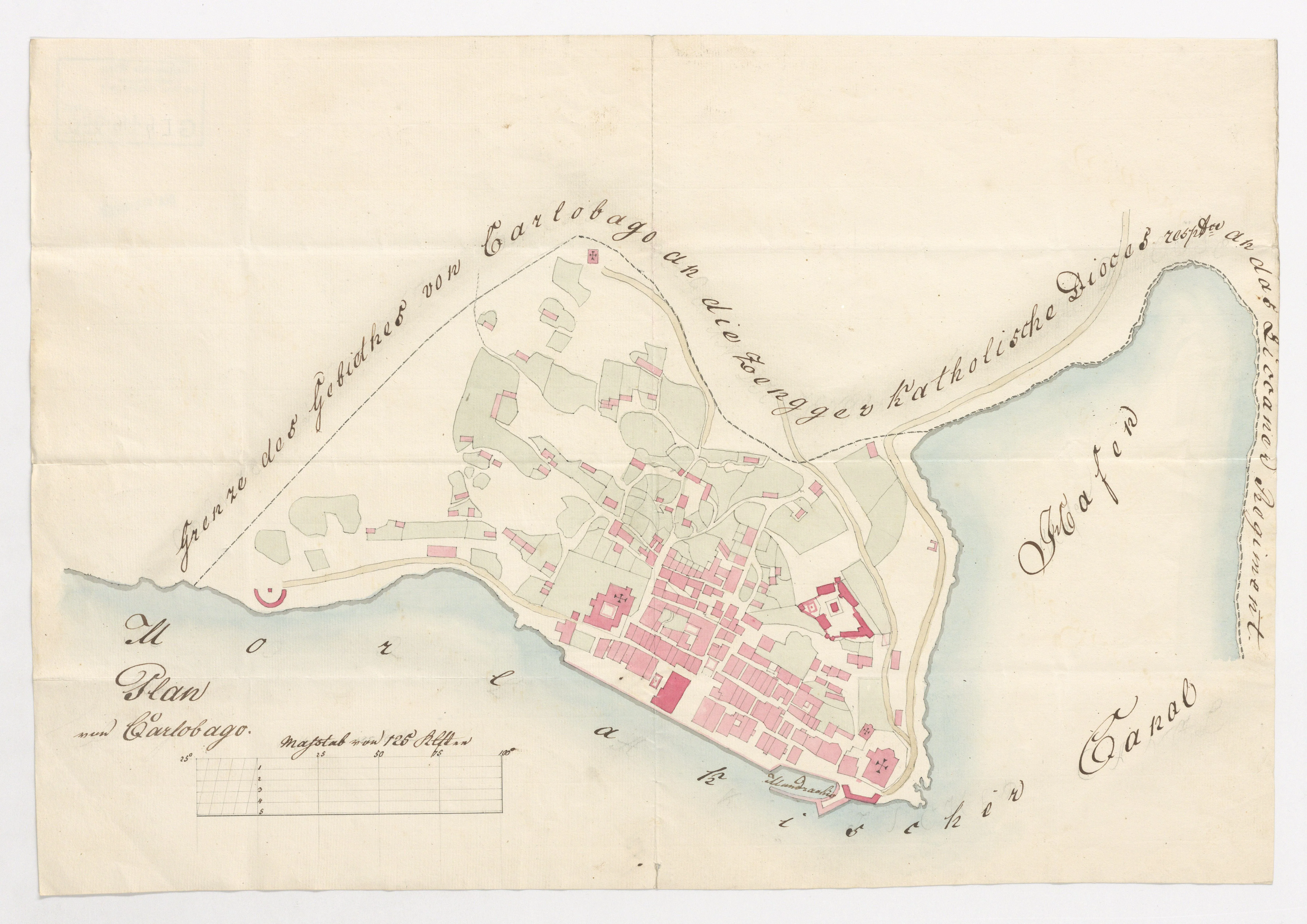
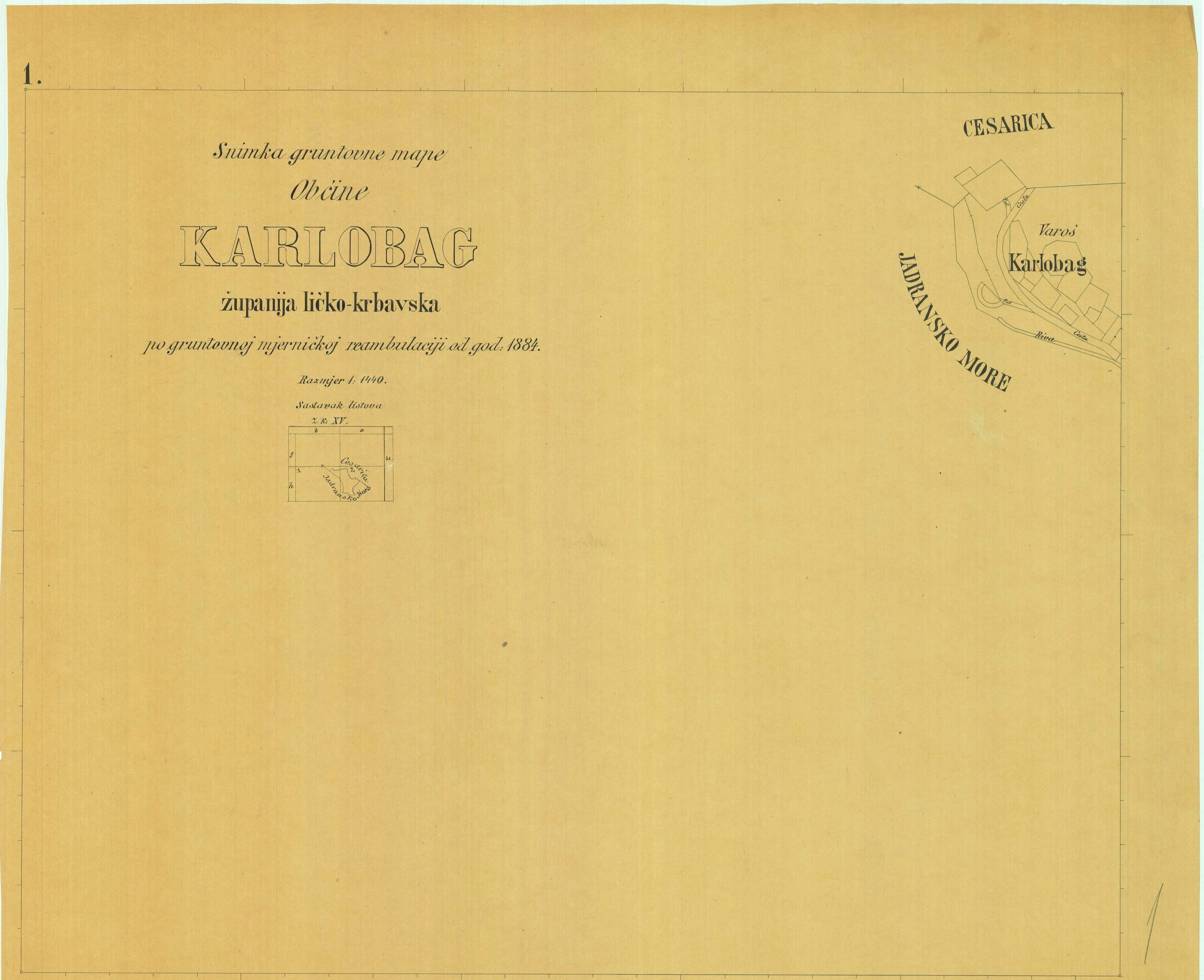
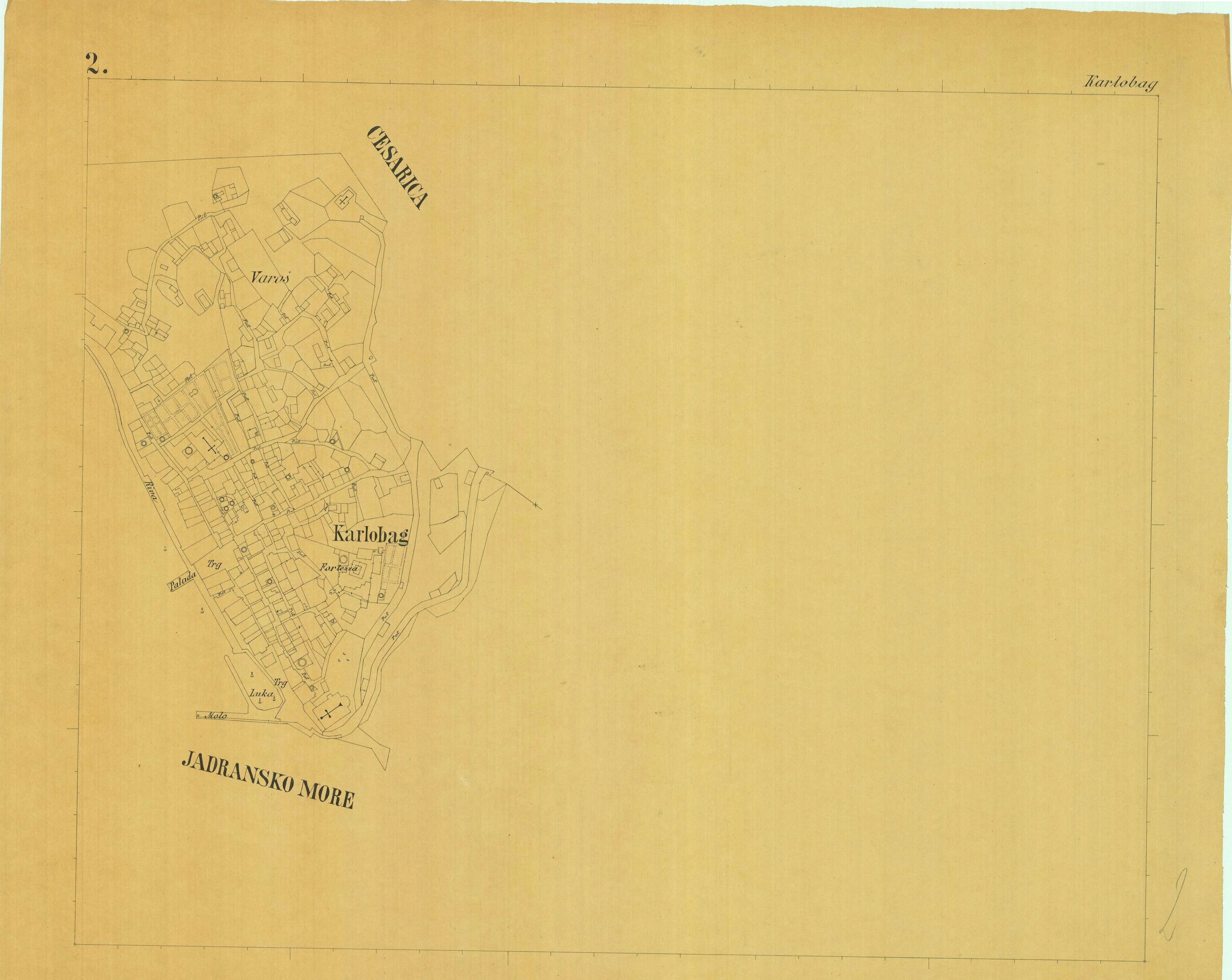
Source: Austrian State Archives in Vienna, catalogue reference AT‑OeStA/KA KPS KS G I h 116‑950.
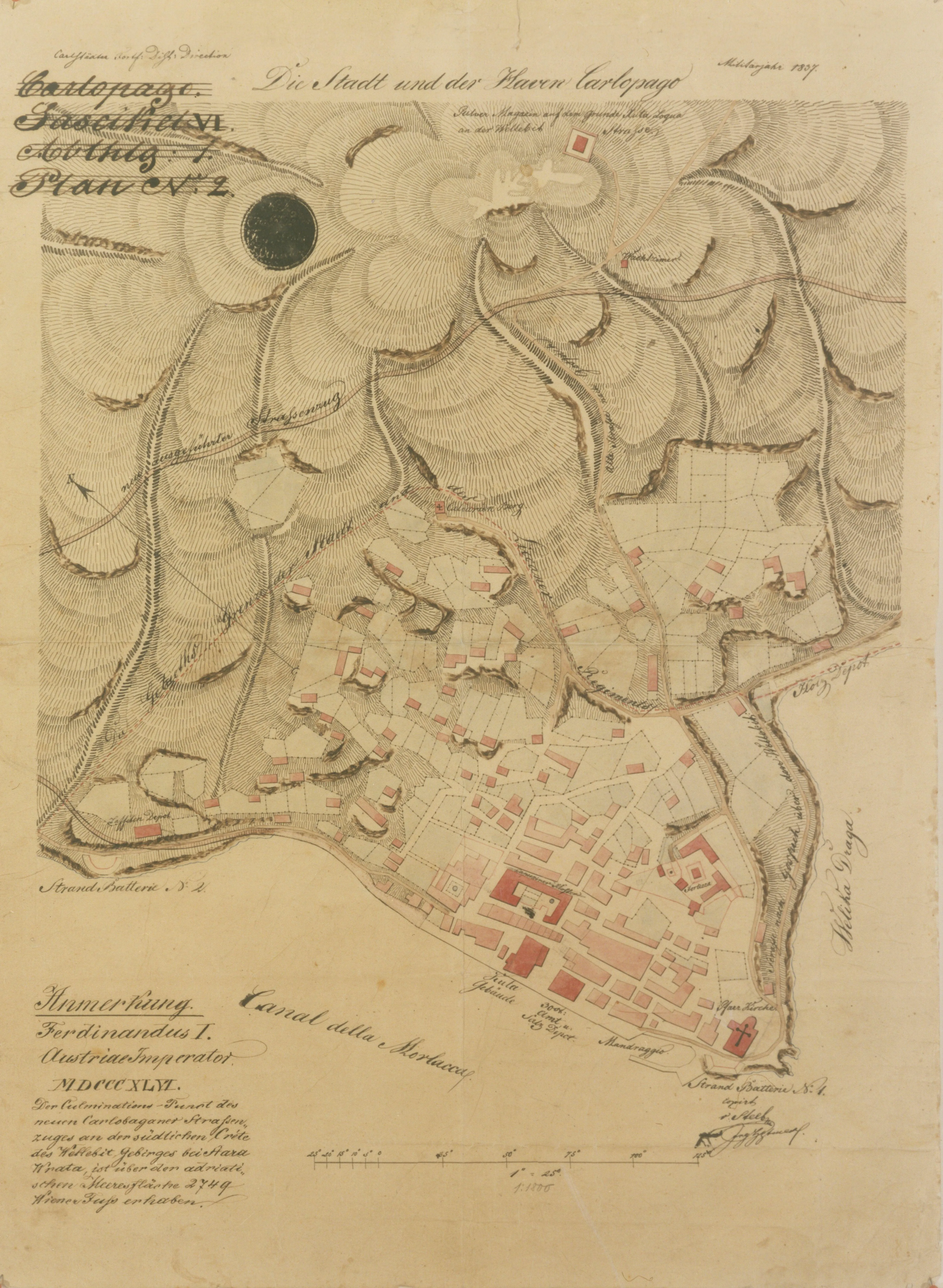
“Morlakichir” or “Canale della Morlacca” – Historical name for the Velebit Channel. “Morlakichir” or “Canale della Morlacca” appears on Austro-Hungarian and early 19th-century Italian maps. The name comes from the Morlaks (Morlaci), an ethnic group that lived in the hinterland of Velebit and the wider Dalmatian region.
Source: Austrian State Archives in Vienna, catalogue reference AT‑OeStA/KA KPS KS G I h 117.