The History of Cartography
Historical maps show how knowledge of the world, the Adriatic and the area of present-day Karlobag changed over the centuries. From medieval symbolic depictions to scientific cartography, each map reflects the knowledge, political interests and historical circumstances of the time in which it was created.
How We Drew the World
Until the 15th century, European ideas about the world were strongly shaped by inherited traditions. Medieval maps often resembled illuminated manuscripts more than navigational tools. On maps known as mappae mundi, Jerusalem was placed at the centre of the world, Paradise at the top, and the edges of the known world were filled with mythical creatures and symbols of the unknown.
A turning point came during the Renaissance, when Ptolemy’s 2nd-century Geography was rediscovered. Claudius Ptolemy introduced a system of meridians and parallels, giving cartography a mathematical and scientific foundation. His image of the world nevertheless contained many inaccuracies: he believed the Earth to be smaller than it is, knew nothing of the American continents, depicted the Indian Ocean as an enclosed sea, and joined Africa to an imagined southern landmass.
THE AGE OF GREAT CORRECTIONS
The voyages of Christopher Columbus, Ferdinand Magellan and Vasco da Gama brought discoveries that fundamentally changed the established image of the world. The period from 1500 to 1600 was one of the most exciting in the history of cartography—an age of constant revision, correction and new discoveries.
THE TURNING POINT AROUND 1600
Around 1600, the centre of European cartography shifted to Amsterdam, and the Netherlands became the world’s leading centre for printing and trading maps. Accurate maps were an important source of political, military and economic power.
FROM SEA MONSTERS TO SCIENCE
Maps made before 1600 often featured sea monsters devouring ships in unknown waters. They were not merely decorative, but symbols of gaps in knowledge and fear of the unknown. As the 17th century approached, such images gradually disappeared and were replaced by more precise figures, soundings, coordinates and astronomical measurements.
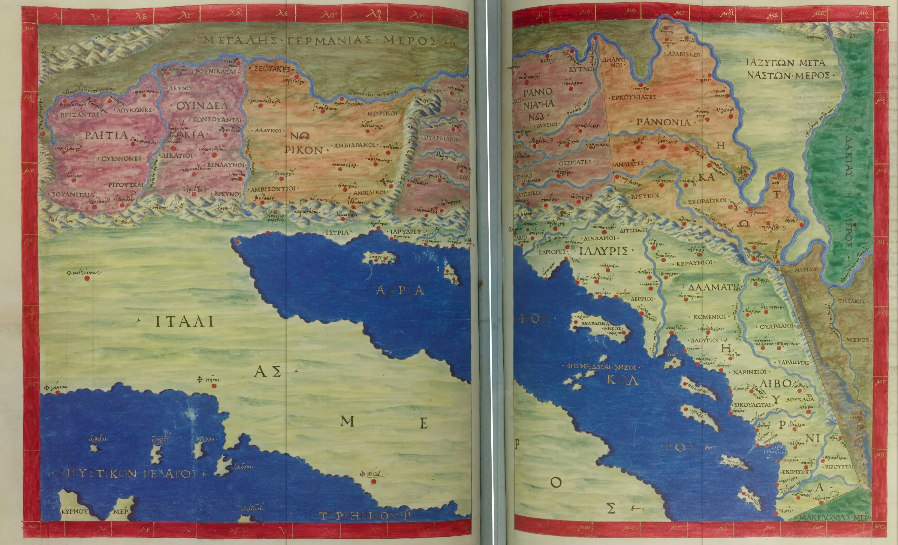
Croatia and the Adriatic Sea (1300)
Author: Maximus Planudes (c. 100–170 AD - transcription based on Ptolemy)
On the right side, next to the red dot on the coast, it says ουέγια (ouegia) (the ancient name for present-day Karlobag).
In 1295, Planudes found a manuscript containing Ptolemy's text and long lists of coordinates (latitude and longitude) for cities, mountains, and rivers. Planudes did not "correct" Ptolemy by adding new discoveries of his time. He literally took Ptolemy's numbers (coordinates) and redrew the maps based on them. His goal was to revive what Ptolemy described, rather than create a modern 13th-century map.
Source: Bibliothèque nationale de France (BnF).
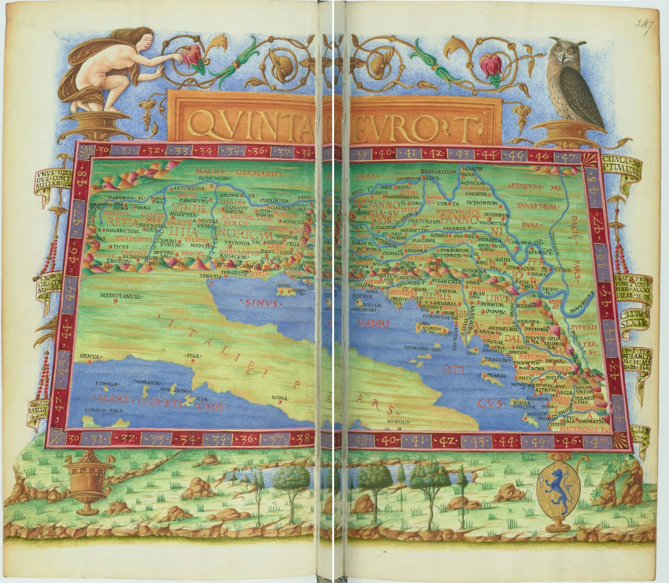
Croatia and the Adriatic Sea (1475)
Author: Jacobus Angelus (1360–1410).
The map was created by the Italian humanist and translator of ancient Greek texts during the Renaissance, Jacobus Angelus (1360–1410). He is best known for his translations of Ptolemy's "Geography" from Greek to Latin (around 1406). It was he who gave the work the title Geographia (Ptolemy called it Geōgraphikē Hyphēgēsis). His work allowed Renaissance cartographers to rediscover the mathematical principles of mapmaking, which directly paved the way for the great atlases of the 16th and 17th centuries.
The map was published as part of the 1475 Geographia atlas by Claudius Ptolemy, the Greco-Roman geographer, astronomer, and mathematician who lived in Alexandria (c. 100–170 AD).
Ancient names for places and cities are used on the map. Vetia is present-day Karlobag. Ortopla/Ortpijla is today's Stinica.
On ancient Greek maps, Stinica was written as Ὀρθόπυλα (Orthopyla). Often, in transcriptions during Renaissance-era engraving, that "y" or Latin "u" was converted into "ii".
Source: Bibliothèque nationale de France (BnF).
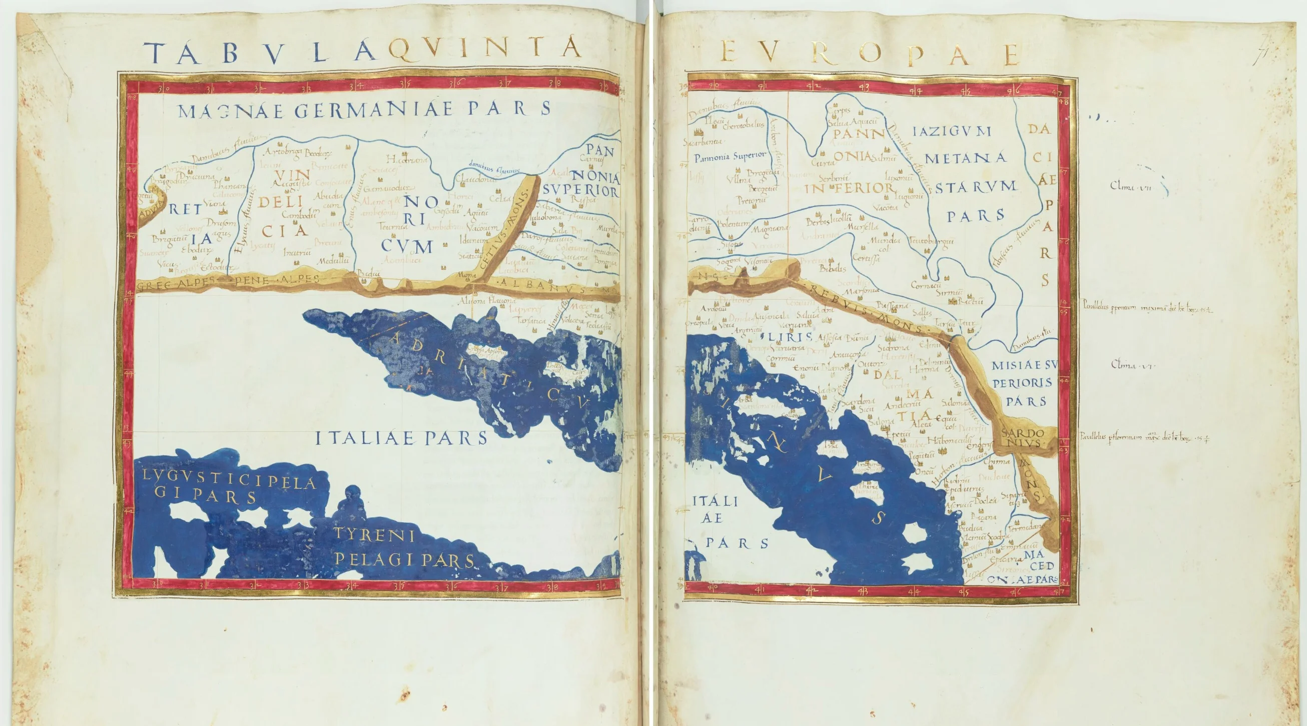
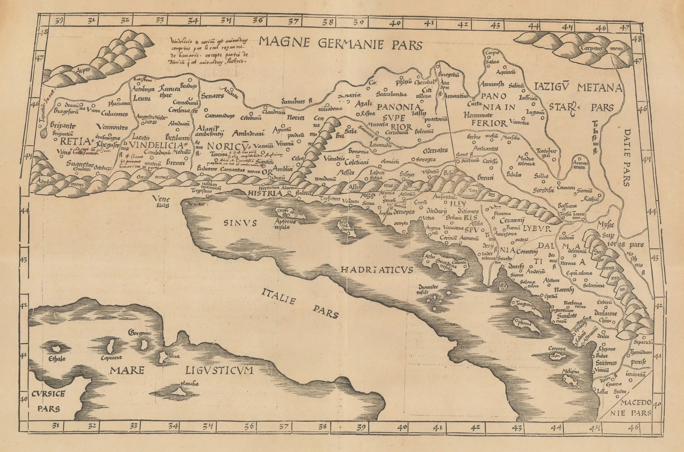
Croatia and the Adriatic Sea (1490)
Author: Nicolaus Germanus (1420–1490)
On the right side, next to the red dot on the coast, the inscriptionVetiais clearly visible.
After the fall of the Roman Empire, this knowledge was almost forgotten in the West. It wasn't until the 15th century, thanks to Jacobus Angelus's translation from Greek to Latin, that Europe rediscovered Ptolemy. Although Angelus translated the text, the visual identity of the map seen in the 1490 edition is credited to Nicolaus Germanus, a German cartographer who worked in Italy.
Germanus introduced a revolutionary change:
* He introduced the Donis projection (trapezoidal projection) which attempted to more accurately represent the Earth's curvature on flat paper.
* His maps became the standard for luxury editions owned by kings and wealthy merchants.
The 1490 edition was printed in Rome and is actually a reissue of the famous 1478 printing. What makes it special is the copperplate engraving technique, whereas early maps were often made with woodcuts.
Source: Bibliothèque nationale de France (BnF).
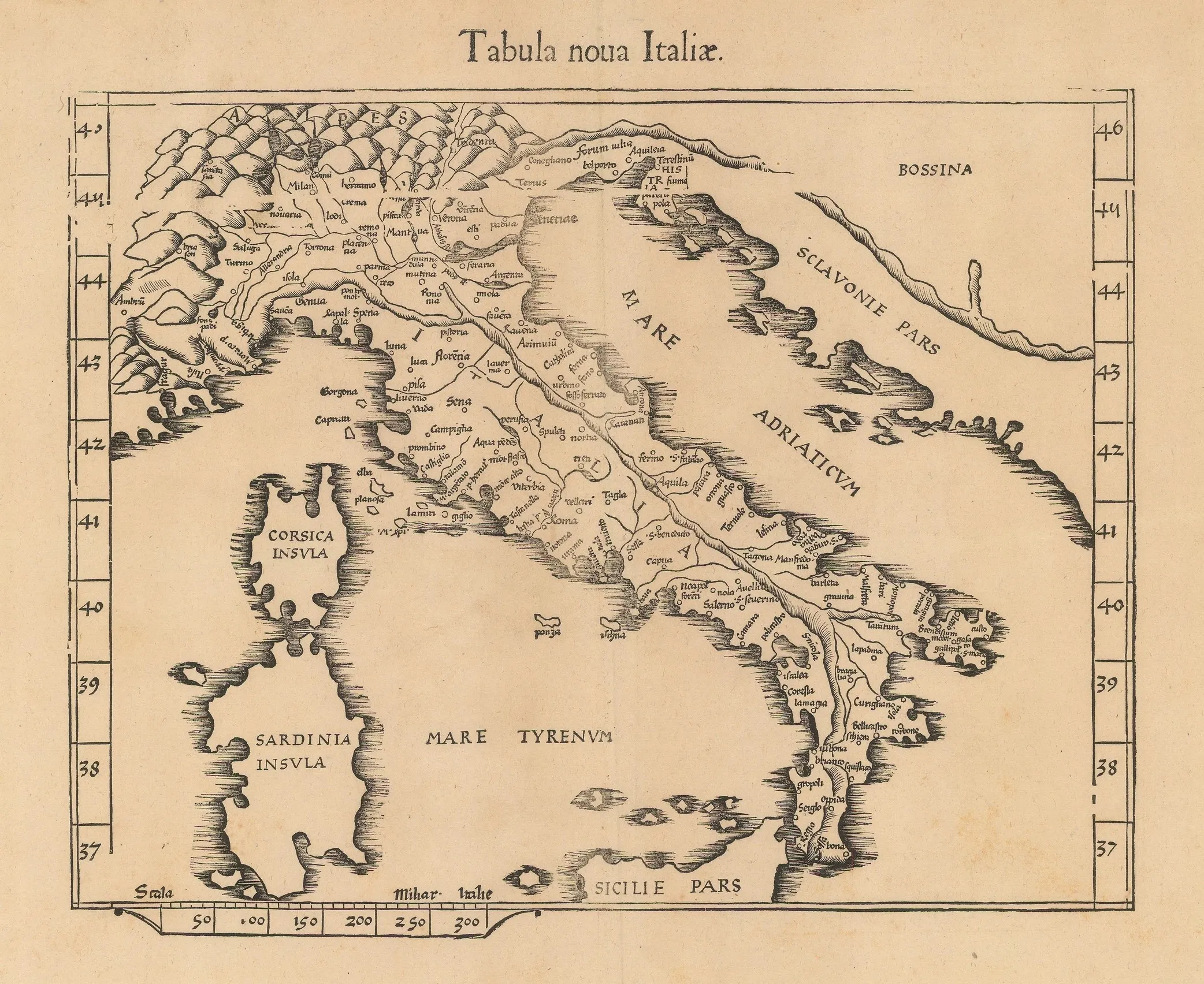
Croatia and the Adriatic Sea (1541)
Author: Laurent Fries (1485–1532)
Also based on traditional Ptolemaic coordinates. At the site of present-day Karlobag stands the old nameVetia, and in the immediate vicinity, today's Starigrad and Stinica (recorded as Ortopla) are also visible.
Fries shortened and adapted the texts of earlier atlases to make them more accessible and affordable to a wider audience.
Source: Bibliothèque nationale de France (BnF).
Croatia and the Adriatic Sea (1541)
Author: Martin Waldseemüller (1470–1520) & Laurent Fries (1485–1532)
Source: Bibliothèque nationale de France (BnF).
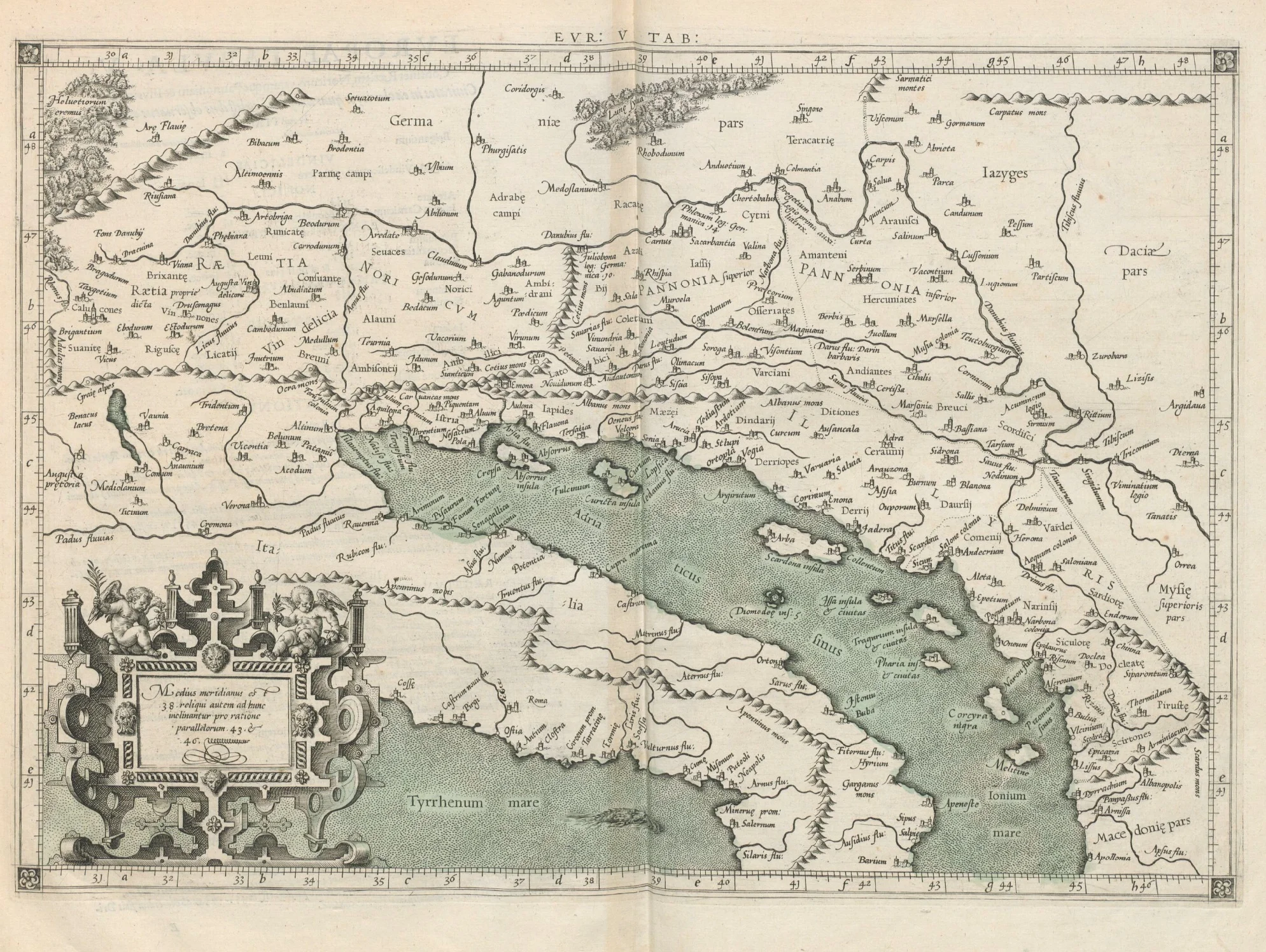
Map of Claudius Ptolemy (1578)
Author: Gerard Mercator (1512–1594)
On the map, the nameVegiastands at the location of present-day Karlobag.
Gerard Mercator used his superior knowledge of mathematics and astronomy to clean up and correct errors made in earlier transcriptions of Ptolemy's coordinates, creating the most faithful Renaissance reproduction of the ancient world.
Source: Bibliothèque nationale de France (BnF).
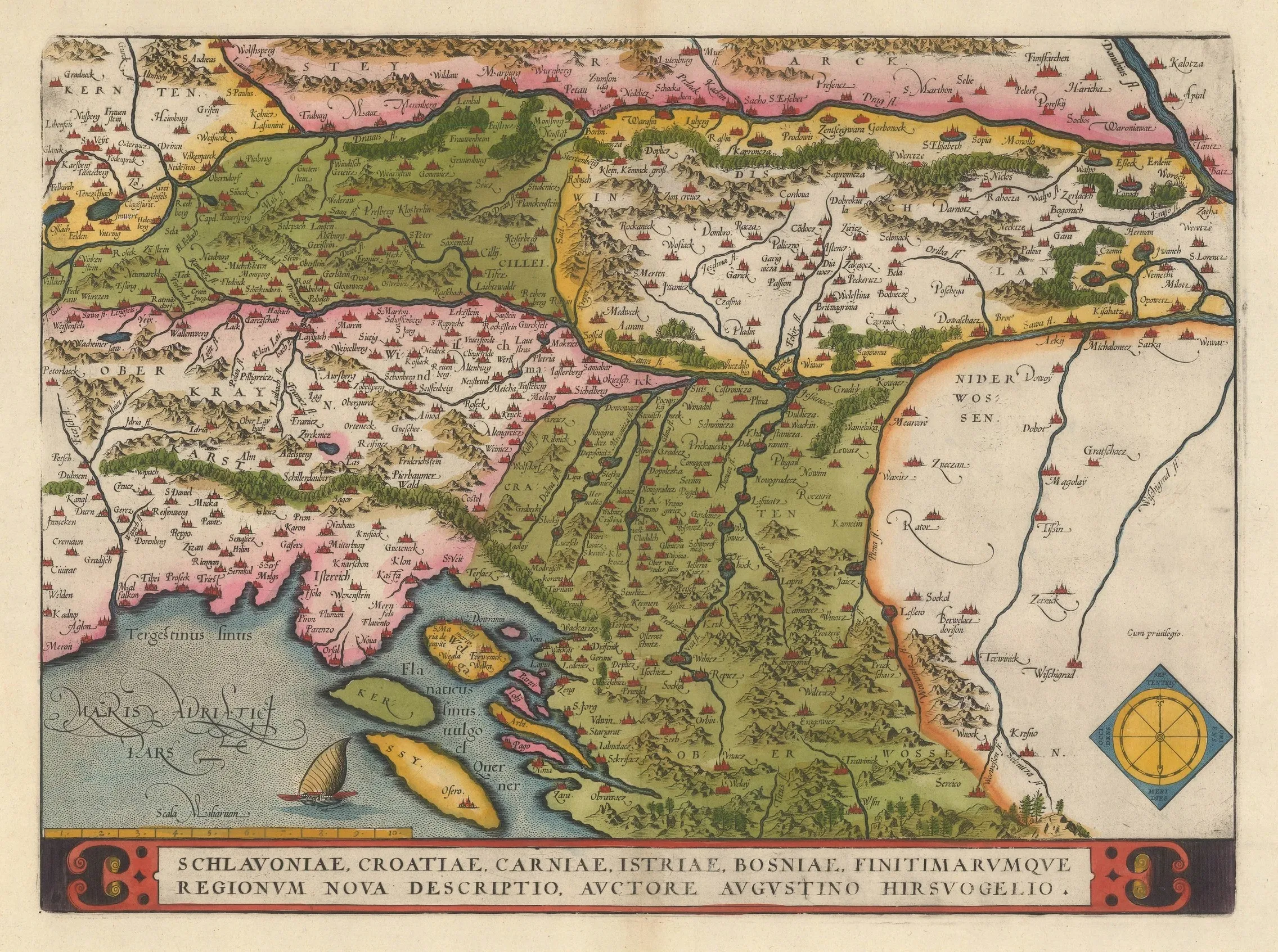
Slavonia, Croatia, Bosnia (1590)
Author: Abraham Ortelius (1527–1598)
At the location of present-day Karlobag, the historical nameSckrisacz(Škrinjica/Bag) is used.
An attractive map from the Dutch Golden Age, covering the area of Slovenia, Croatia, Bosnia and Herzegovina, and part of northern Italy. It is oriented towards the east and was created according to the influential geographical templates of Augustin Hirschvogel (1503–1553), a prominent German cartographer and mathematician.
Source: Bibliothèque nationale de France (BnF).
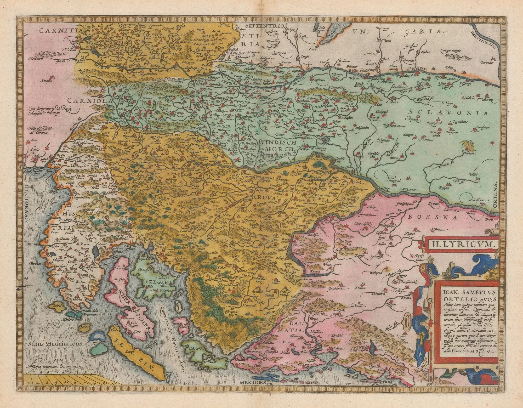
Illyrian Map (1598)
Author: Abraham Ortelius (1527–1598)
An early map of Croatia and neighboring areas of Slovenia, Hungary, and Bosnia and Herzegovina, also showing the ancient province of Illyricum. It is based on the research of the Hungarian humanist, philosopher, and lawyer János Zsámboky (Johannes Sambucus, 1531–1584).
In the lower right part of the map, there is a note:
- Note:
- IOAN. SAMBUCUS
- TO ORTELIUS, [DEDICATES / SENDS] HIS OWN...
“I am also sending you this table/map, in which the necessary boundaries of Pannonia are explained, as well as the positions of rivers and certain places. I have corrected Hirschvogel's positions, and with Angelini's diligence, I have added much and harmonized the distances between them, so that little is missing for one who would want to compare this with Hirschvogel's work.”
“If there are any errors in all this, time will provide more certain information.”
Vienna, farewell, February 25, 1572.
Source: Bibliothèque nationale de France (BnF).
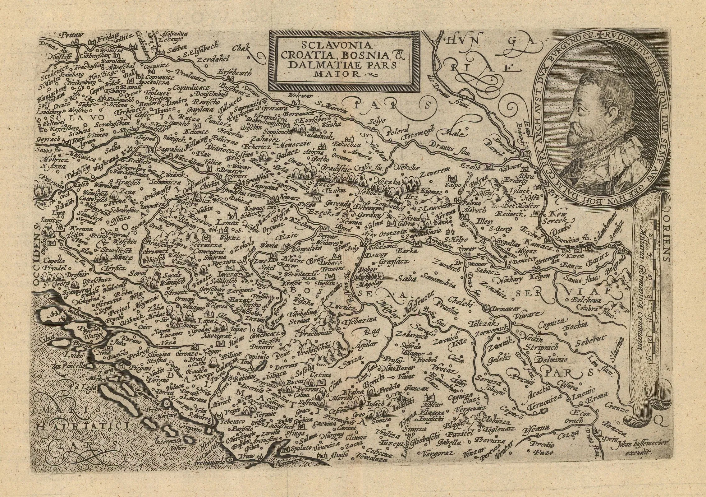
Slavonia, Croatia, Bosnia, and most of Dalmatia (1609)
Author: Matthias Quad (1557–1613)
The nameScixais used for present-day Karlobag. An early copperplate map of Croatia, Bosnia and Herzegovina, and the Dalmatian coast. An inset features a portrait of the Holy Roman Emperor, Rudolf II (reigned 1576–1612). Printed by Johann Bussemacher.
Source: Austrian State Archives, Vienna.
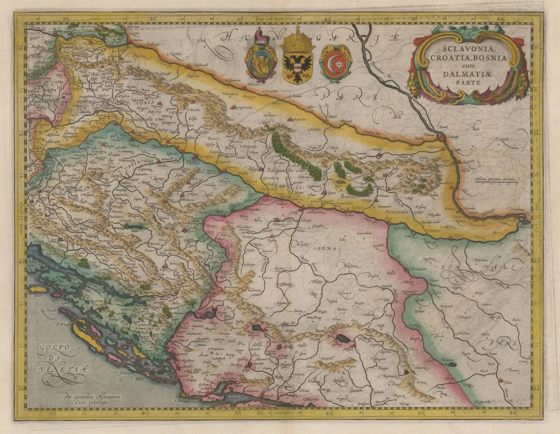
Slavonia, Croatia, Bosnia, and Dalmatia. Early hand-colored map of the Balkans (1636)
Author: Mercator-Hondius (1563–1612)
The nameScixastands at the location of present-day Karlobag.
Source: Austrian State Archives, Vienna.
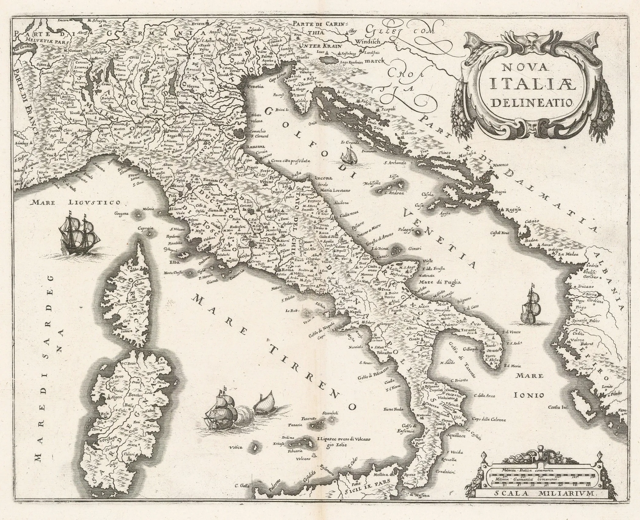
Map of New Italy (1646)
Author: Matthäus Merian (1593–1665)
The nameSelisais recorded at present-day Karlobag. A strong impression of Merian's map of Italy, based on Blaeu's map.
This map was published in Merian's great work "Neuwe Archontologia Cosmica," a geographical description of all the world's kingdoms. The text was written by Johann Ludwig Gottfried, while the maps, vedutas, and panoramas were created by Matthäus Merian the Elder.
The work contains a collection of panoramas often showing important cities in their 17th-century glory. The maps are largely based on the works of Willem and Joan Blaeu, although Merian adapted them—reducing their size and often simplifying decorative elements.
Source: Austrian State Archives, Vienna.
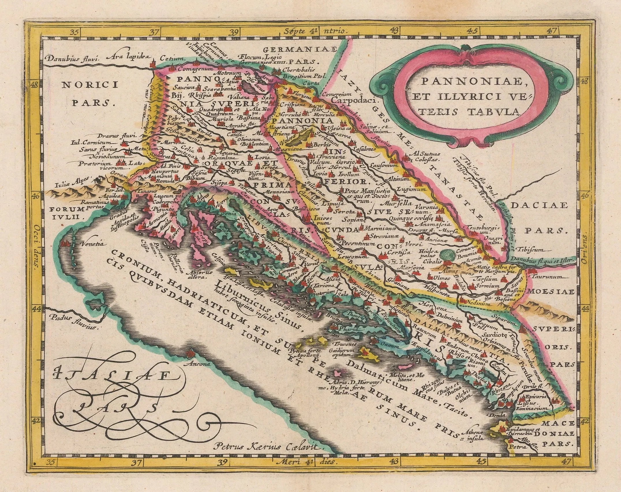
Map of Ancient Pannonia and Illyricum (1661)
Author: Jan Jansson (1588–1664)
The nameVegastands at present-day Karlobag.
This map shows the Adriatic coast of the Balkans in the classical period, covering areas of modern-day Croatia, Montenegro, Bosnia, and Serbia. It represents an important historical-geographical source for understanding the ancient period on the eastern Adriatic coast.
The map was originally part of a significant scholarly work on the history of geography and cartography compiled by Philipp Clüver (Philip Cluverius), a pioneer of modern historical geography. His monumental work, *Introductio in Universam Geographiam*, published in 1624, is among the most influential geographical publications of the 17th and early 18th centuries.
This copy comes from the 1661 edition published by Johannes Jansson. In this edition, Jansson included a series of maps—both modern, based on his own work and the *Mercator Minoris*, and classical, relying on Mercator's edition of Ptolemy's *Geography* and Ortelius's *Parergon*.
Source: Austrian State Archives, Vienna.
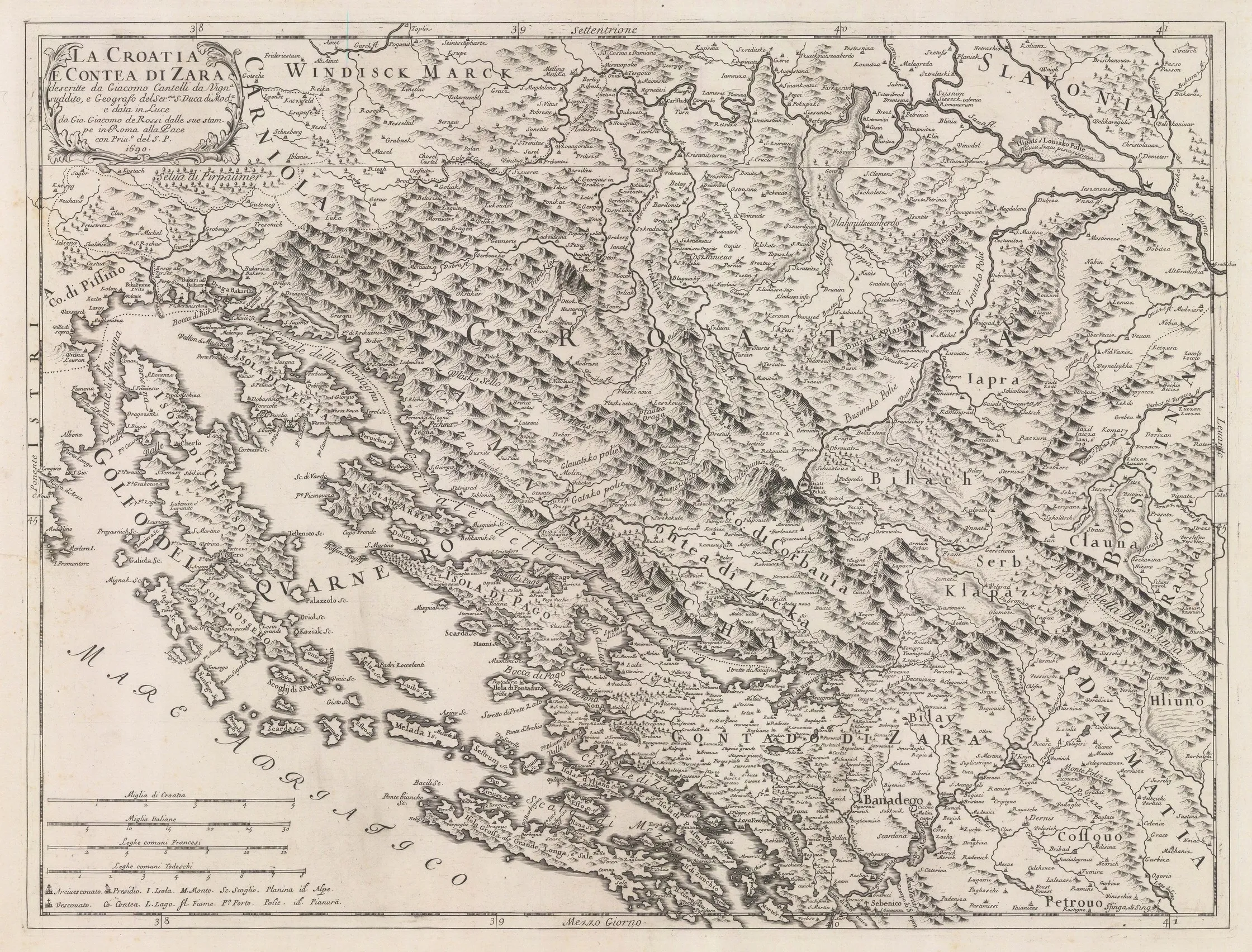
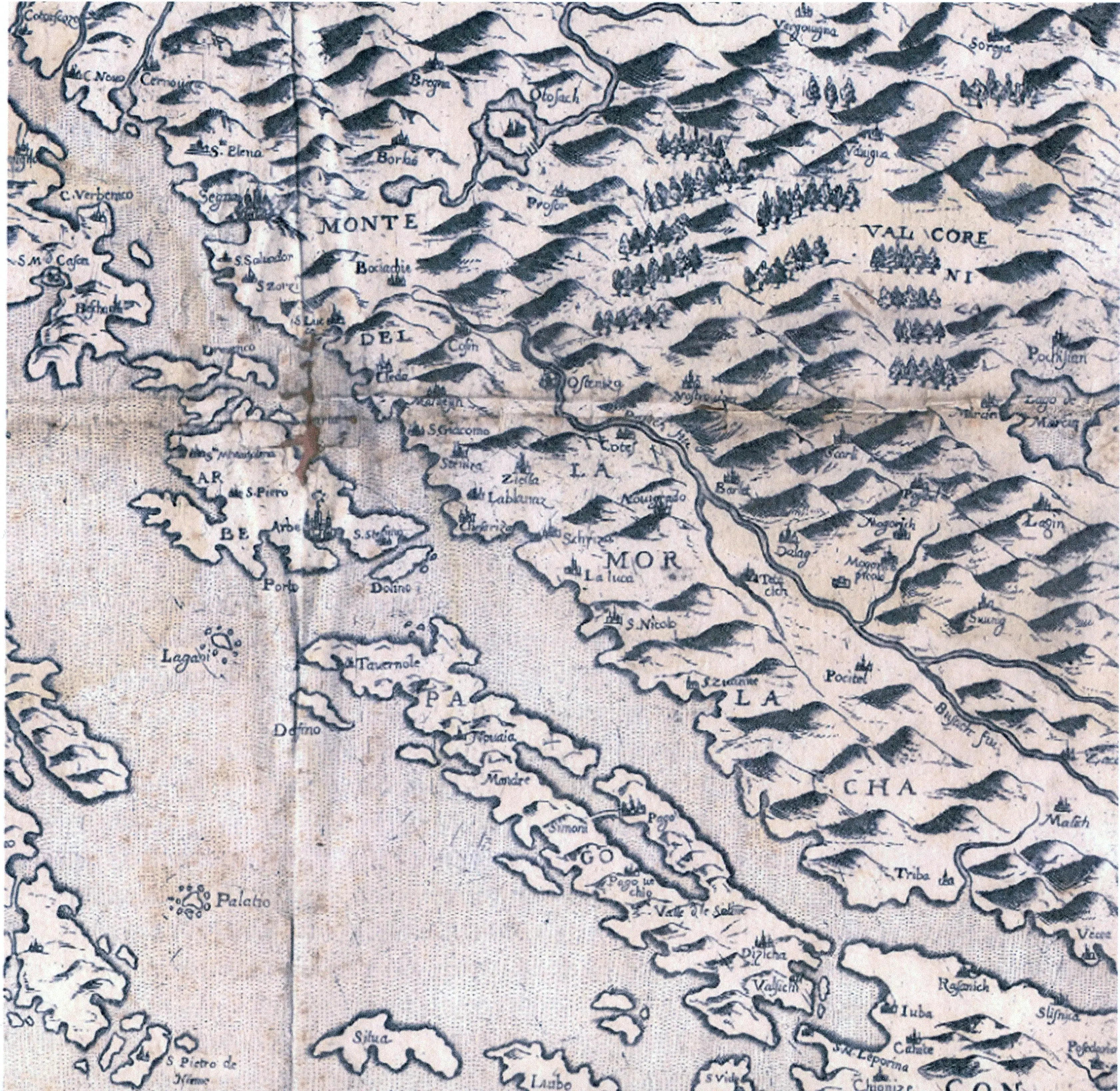
Croatia and the County of Zadar (1690)
Author: Giovanni Giacomo Rossi (1627–1691)
BothScixaandCarlobagnoare marked at present-day Karlobag.
A strong impression of a beautiful copperplate map of the Croatian Adriatic coast by Rossi, showing the area from Rijeka in the north to Šibenik in the south. The map extends into the hinterland as far as Karlovac and Sisak. The mountainous relief of the region is beautifully depicted through hundreds of individually engraved mountains.
Source: Austrian State Archives, Vienna.
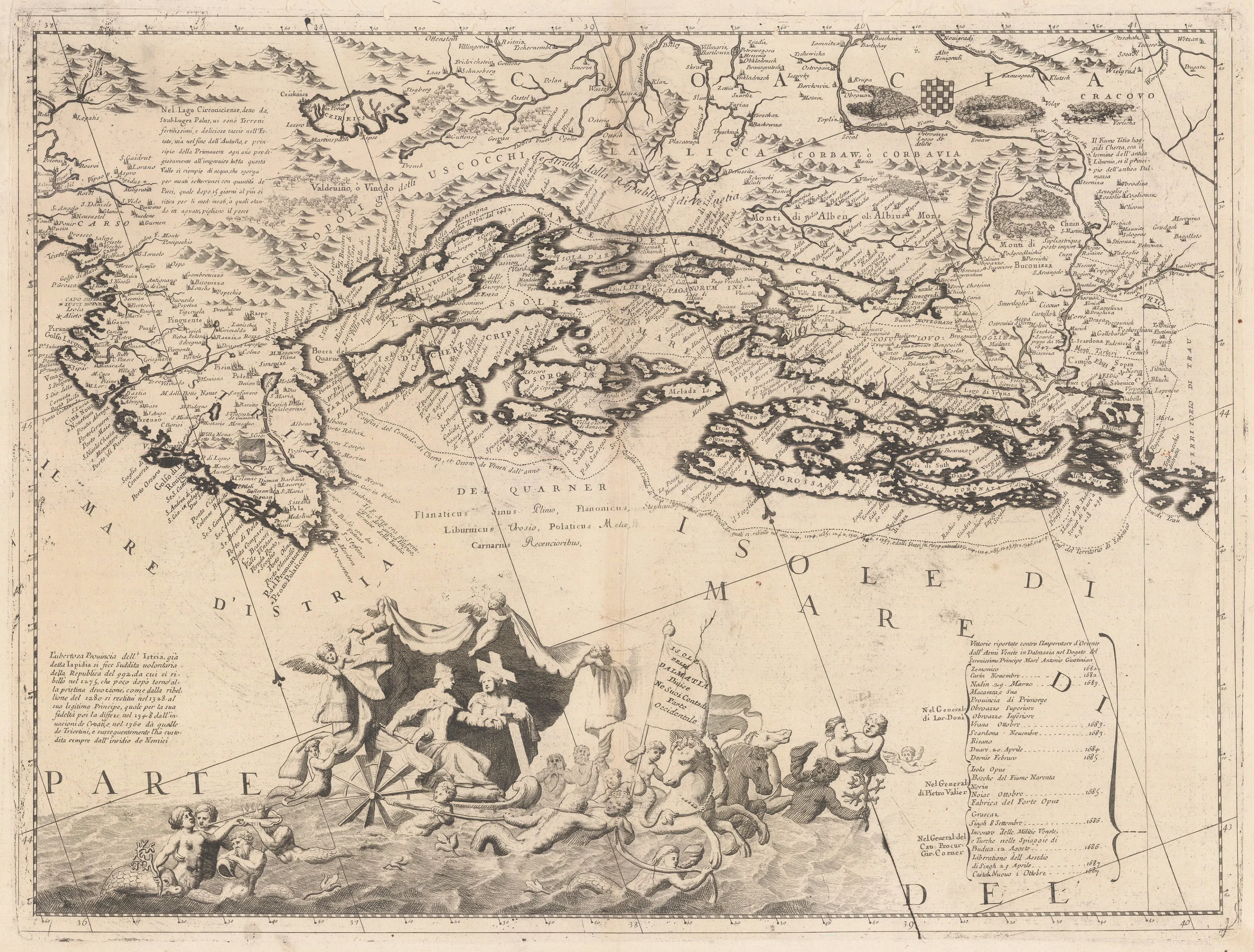
Northern Adriatic Islands on a Venetian Map (1696)
Author: Vincenzo Maria Coronelli (1650–1718)
At the location of present-day Karlobag, the inscription„Serissa o / Carlobago destrutta da Vene da Vscocchi“is recorded, implying that Karlobag was in ruins at the time of the map's creation following attacks by Venetians and Uskoks. This is supported by reports from the Austro-Hungarian cartographer Martin Stier, who also described and sketched Karlobag as destroyed. This cartographic record testifies to historical conflicts and emphasizes the significance of this area in the historical and spiritual context of the Velebit Channel.
Source: Austrian State Archives, Vienna.
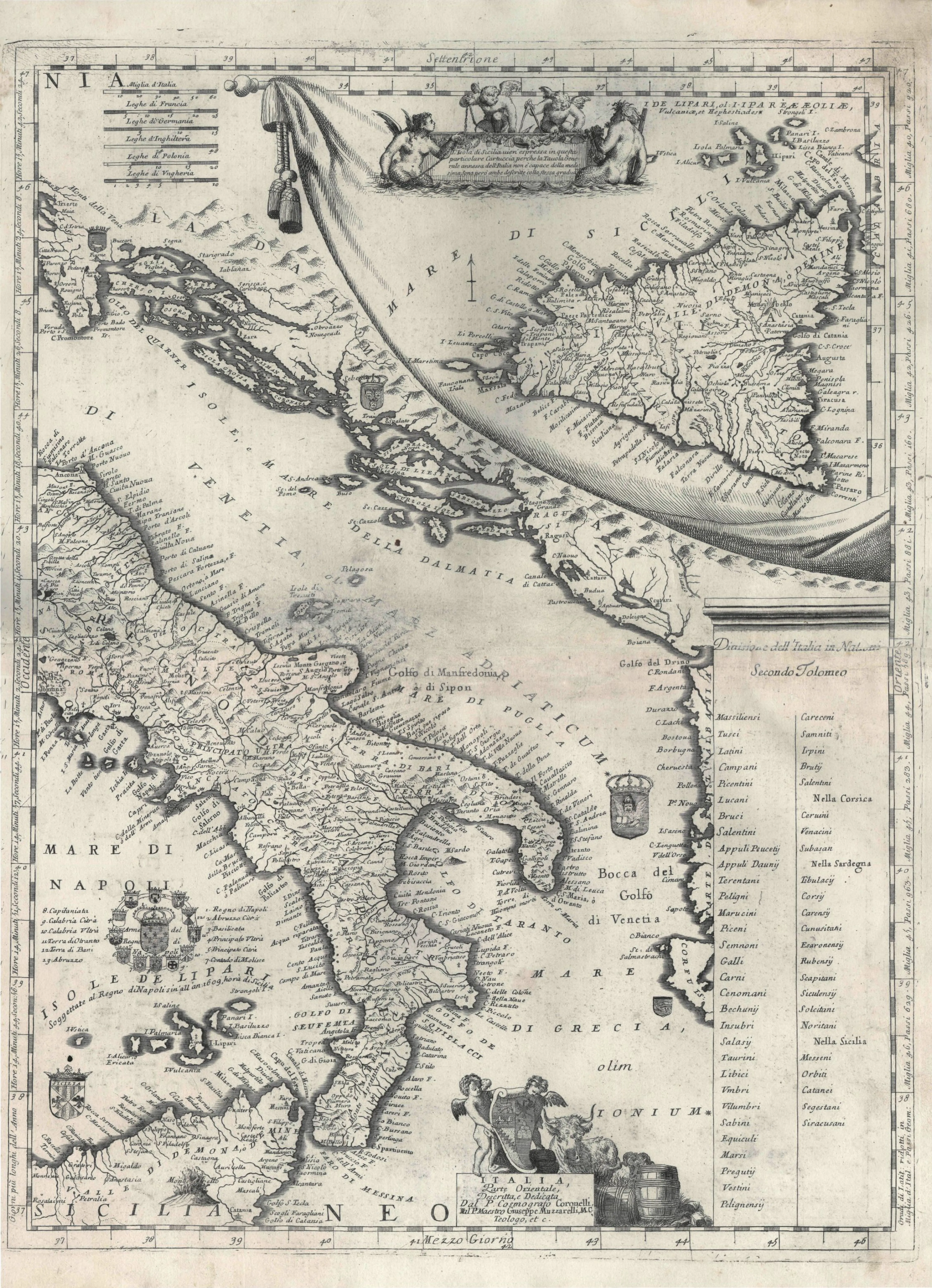
Map of the Adriatic Sea (1696)
Author: Vincenzo Maria Coronelli (1650–1718)
The inscriptionSerissa, o Carlobagois marked at present-day Karlobag.
Source: Austrian State Archives, Vienna.
Velebit Channel and Islands on a Venetian Map from the first half of the 17th century
Author: Unknown
On a 17th-century Venetian map, the name„S. Zuanno“(Venetian form for San Zuanno, i.e., San Giovanni/St. John) is written at present-day Karlobag. This refers to the Church of St. John, which was located in the centre of the town at that time. Later, the Church of St. Charles Borromeo was built on the same site, taking over the spiritual role of the older church. This record testifies to the continuity of sacred tradition in Karlobag.
Source: Austrian State Archives, Vienna.
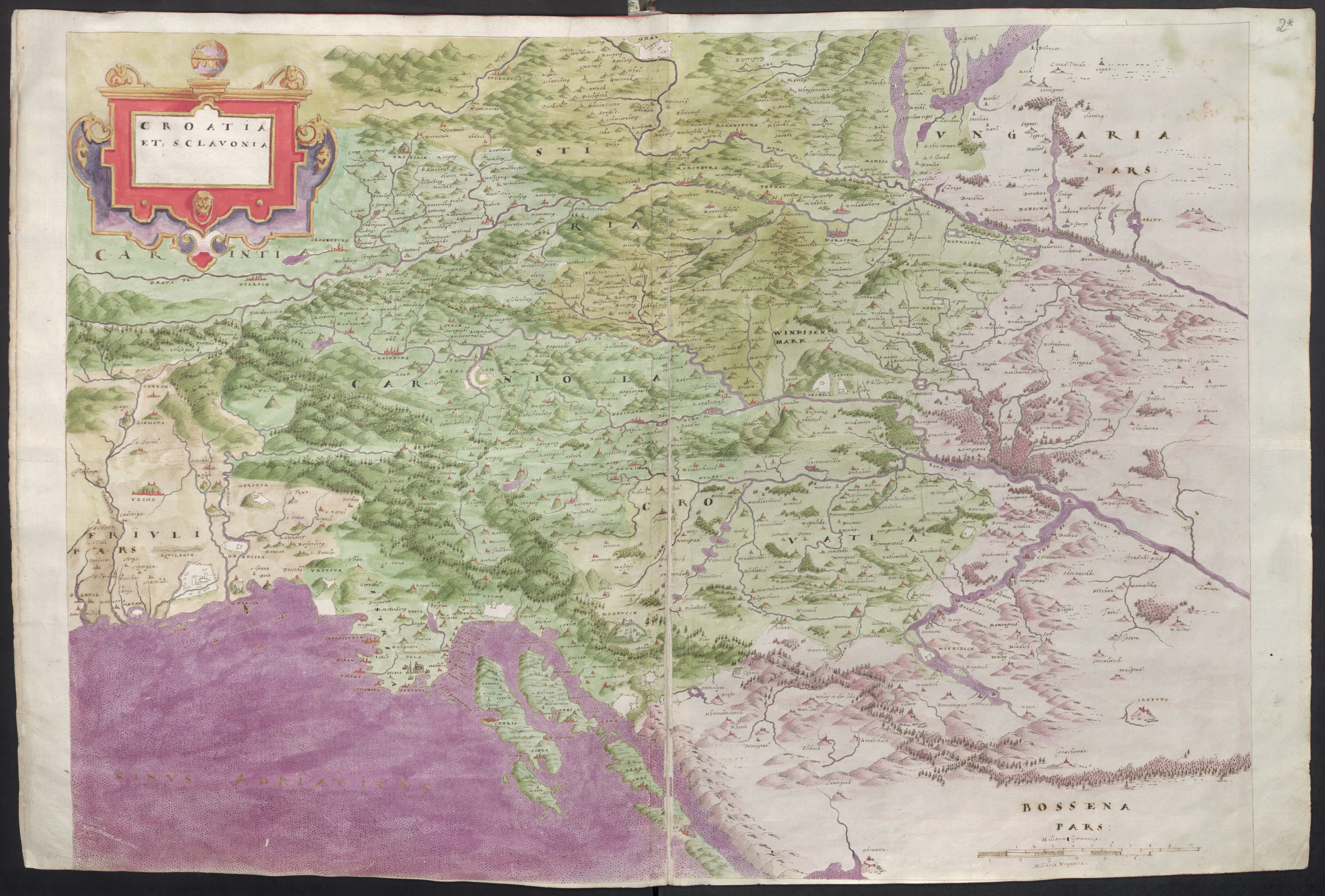
Map of Croatia and Slavonia (1660)
Author: Martin Stier (1620–1669)
Since Karlobag lay in ruins at that time, it was not even drawn on the map.
Source: Austrian State Archives, Vienna.
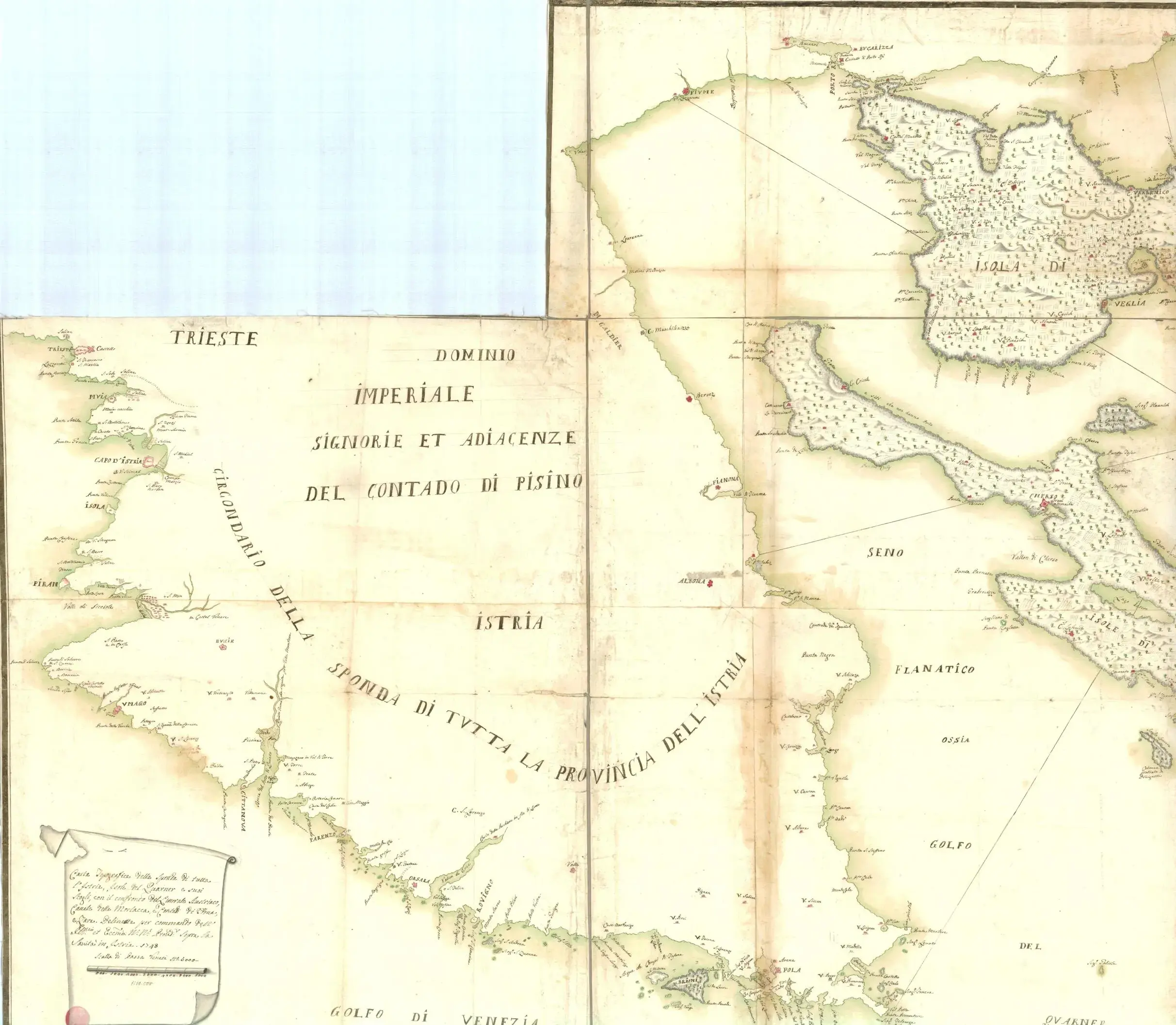
Venetian Map of Istria and Northern Islands 1/2 (1748)
Author: Unknown
There is a note in the left part of the map:
- Topographic map of the entire coast of Istria, the Kvarner islands and its rocks, showing the Austrian coast, the Velebit Channel, and the Zadar region.
- Drawn by order of the Most Illustrious Provider General of the Sea.
- Year 1748.
- Scale: 42,000 Venetian miles
Source: Austrian State Archives, Vienna.
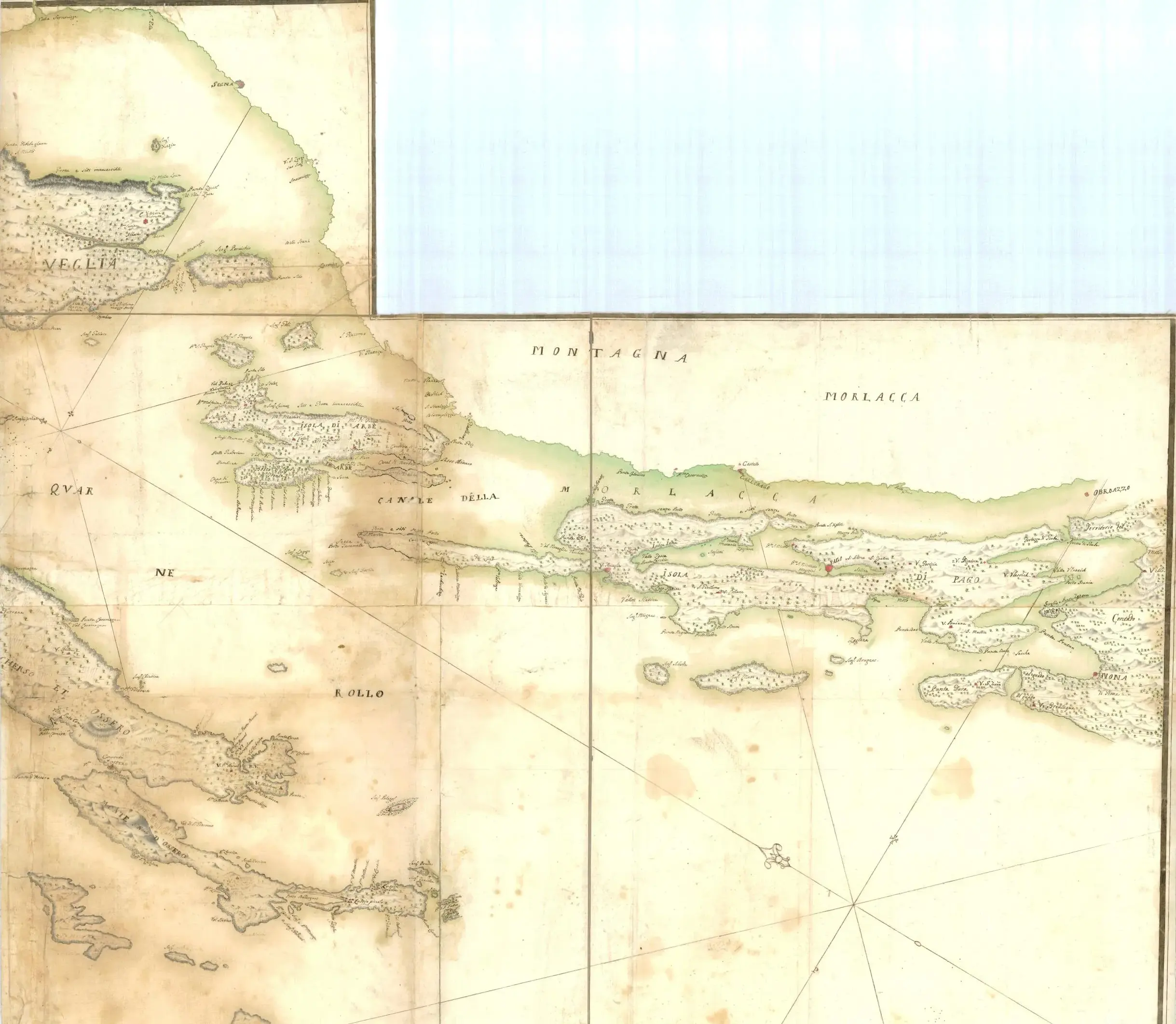
Venetian map of Istria and the northern islands 2/2 (1748)
Author: unknown
Source: Austrian State Archives, Vienna.
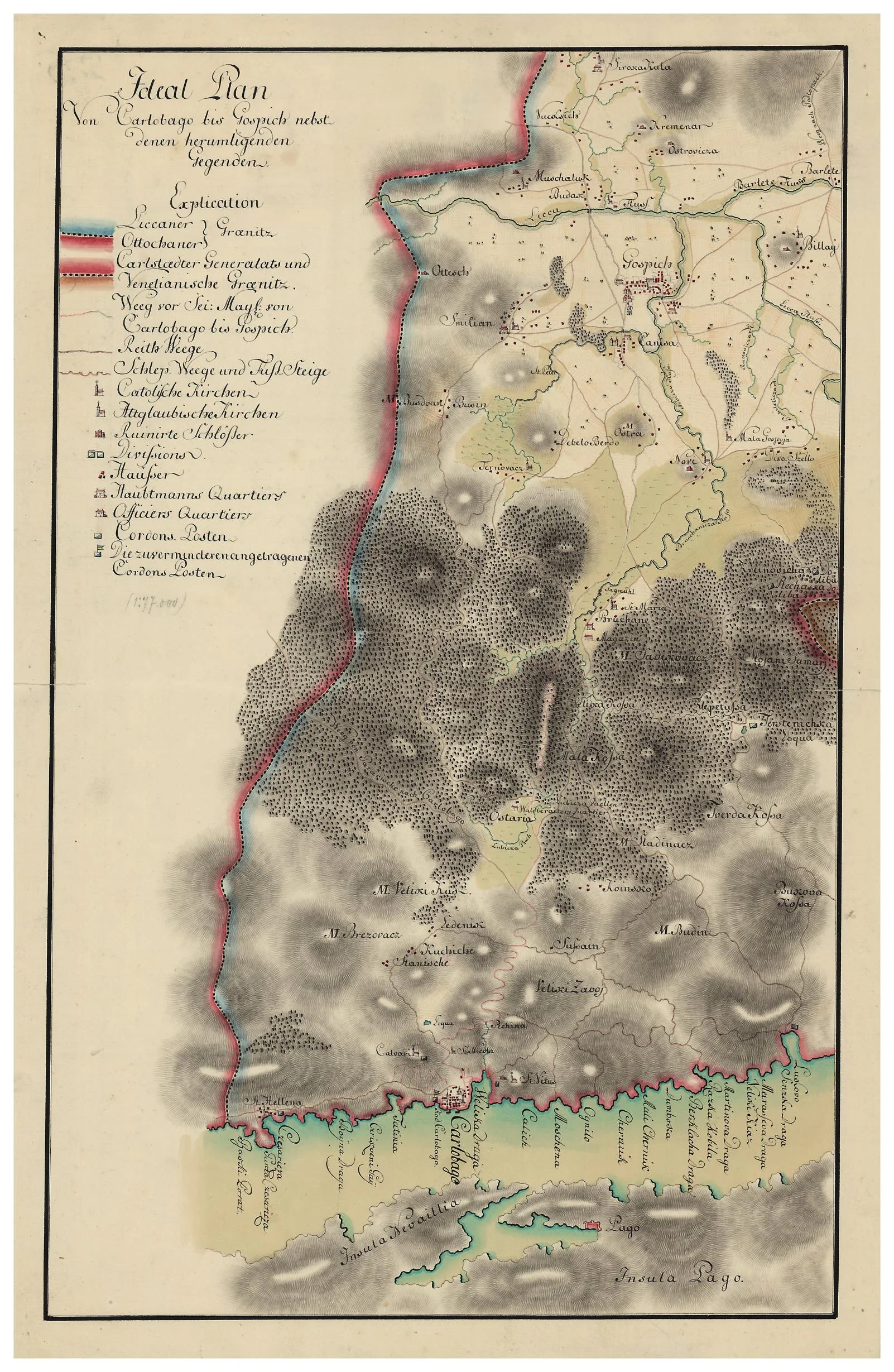
Ideal Plan from Karlobag to Gospić with Neighboring Regions (1770)
Author: Unknown
The year is 1773, and this paper carries an ambitious plan to connect the sea and the land. While the island of Pag is reflected in the blue channel below, Gospić—then an important military centre—is developing in the interior.
This map tells the story of conquering the mountain. Between Karlobag and Gospić stands the rugged Velebit, which the imperial engineer drew with dark shadows, seeking the shortest route for trade and the army. The legend mentions the "Ličani" and "Otočani," frontiersmen who guarded these passes, and paths connecting Catholic and Orthodox churches scattered across the fields.
It is a blueprint of a time when every path was a victory over the karst, and this "Ideal Plan" became the foundation for the road that still connects the heart of Lika with the scent of salt via Baške Oštarije.
Source: Austrian State Archives, Vienna.
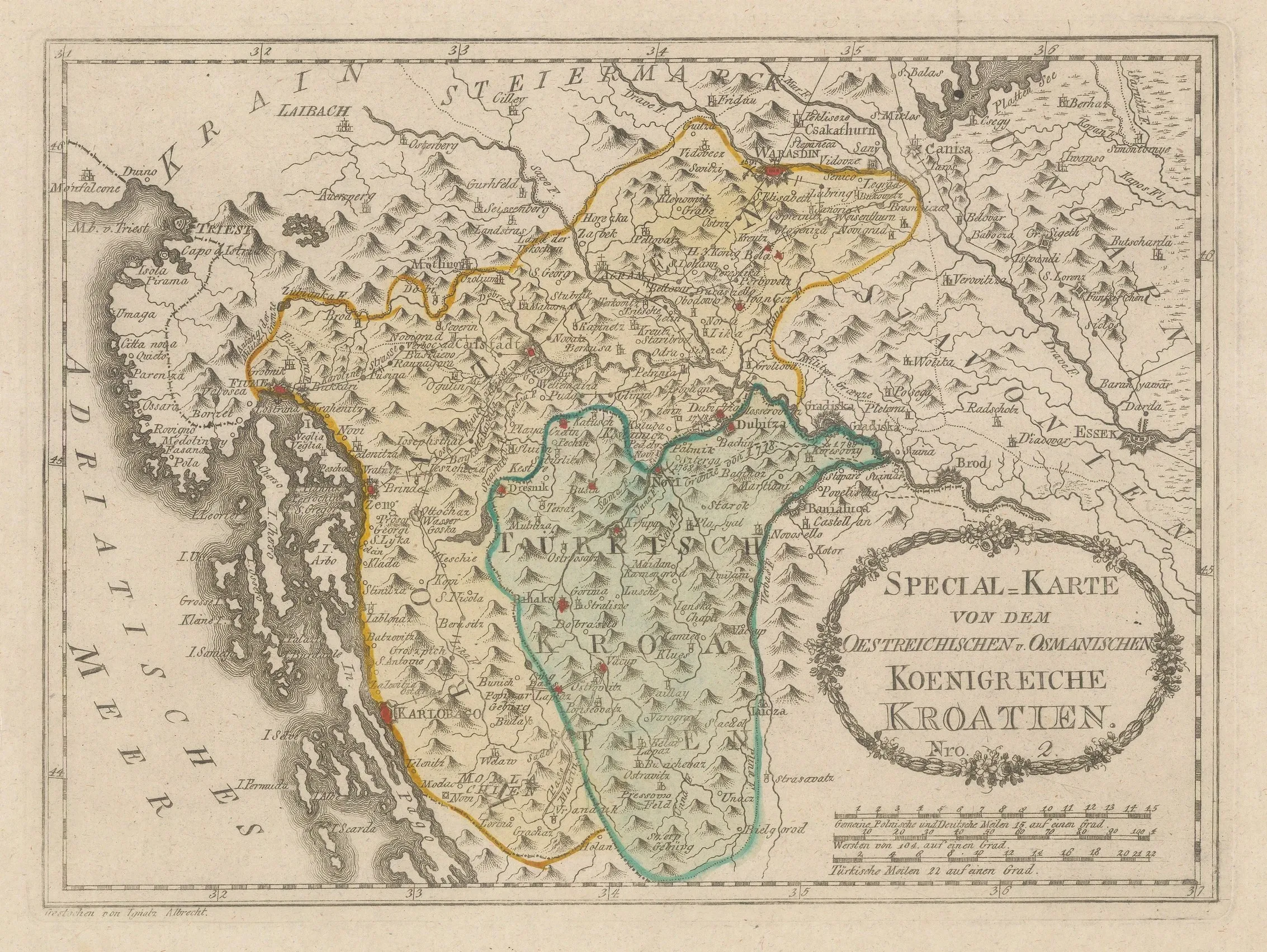
Kingdom of Croatia (1790)
Author: Franz Von Reilly (1766–1820)
An interesting map of Croatia in original colour, showing Turkish and European divisions.
Source: Austrian State Archives, Vienna.
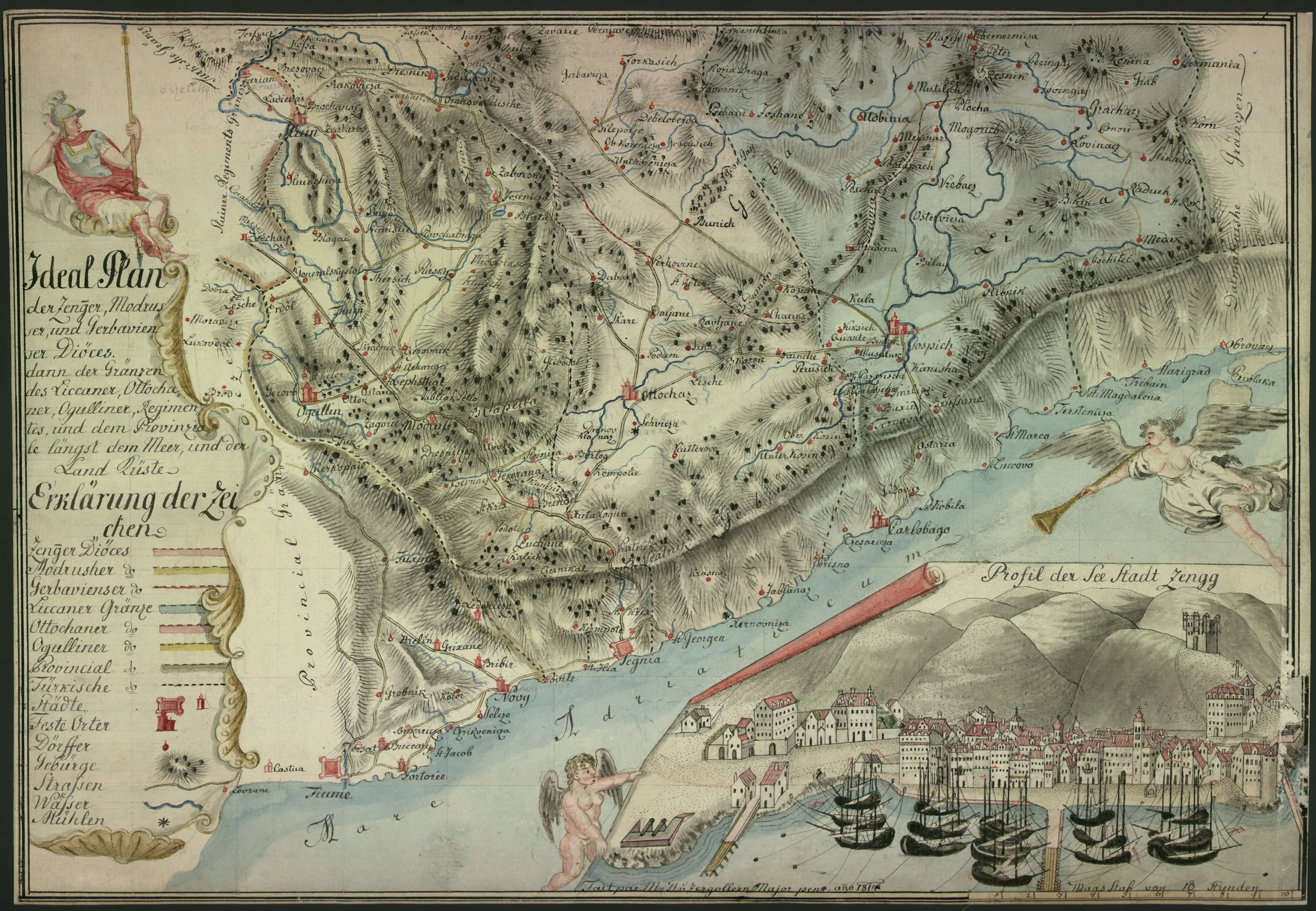
Habsburg Map Senj - Karlobag (1814)
Author: Zergollern
The map is made according to a scale where 10 hours of walking represents the total distance—with one hour of walking being approximately 4 to 5 kilometers, depending on the terrain and historical period.
Source: National and University Library, Zagreb, Inventory reference: NBN: urn:nbn:hr:238:558655.
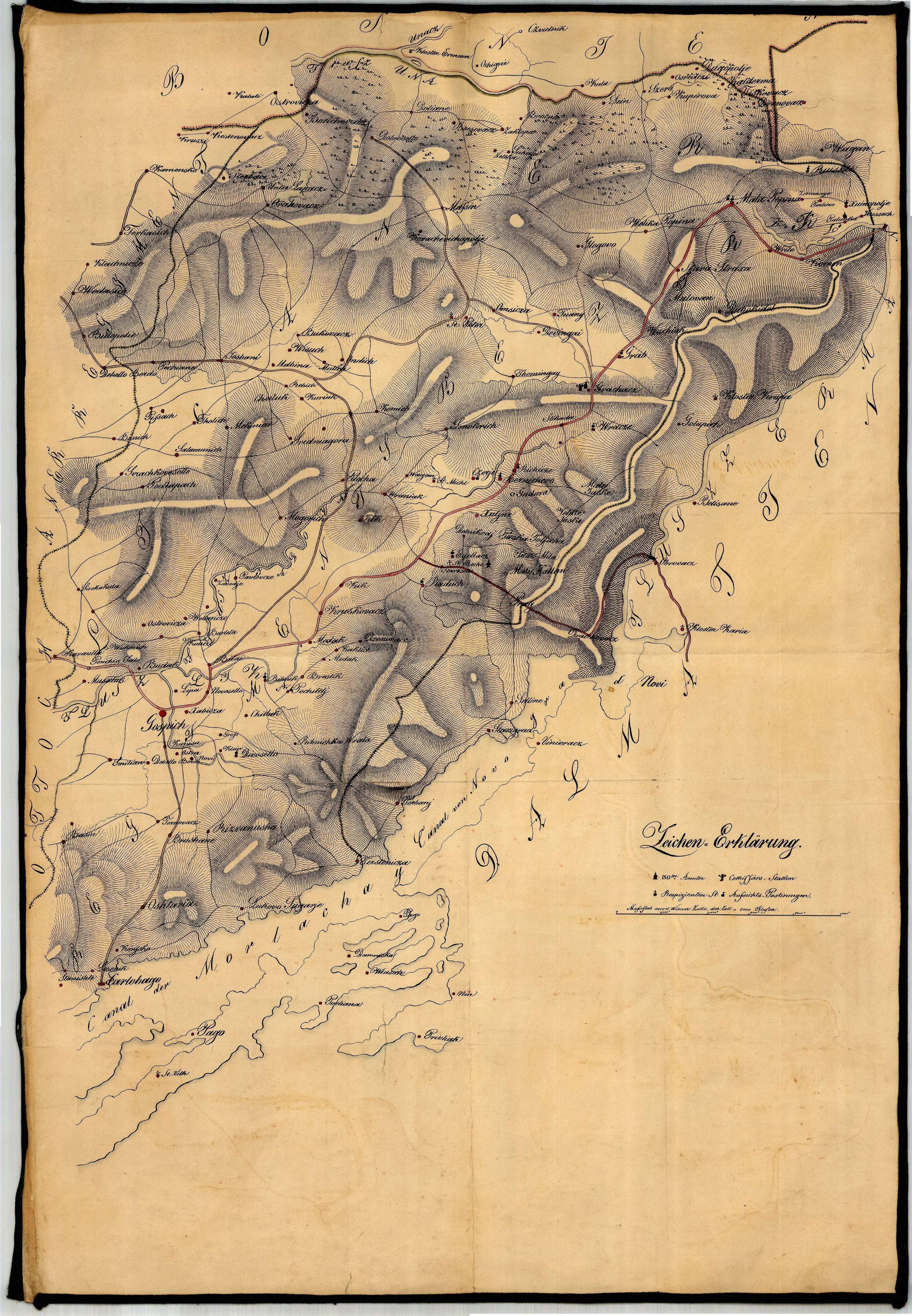
Map of the Southern Croatian Military Frontier (1843)
Author: Unknown
Bastion of the Military Frontier: Map of the Lika Regiment from the Una to the Adriatic (1843)
Before us is a document labeledNo. 16942, a map precisely defining the area of the Southern Croatian Military Frontier in1843. This historical depiction covers the entire area of the Lika Border Regiment, stretching from the untamed Una River in the east to the strategic port of Karlobag in the west.
At that time, every red line and dot on the map signified military duty, watch, and strict discipline under the direct administration of Vienna.
From the Una to Velebit
The map documents the vast territory overseen by the regiment. The Una River dominates the eastern edge as a natural barrier, while moving westward are karst fields and mountain massifs leading toward Karlobag, the regiment's main exit to the sea.
Military Organisation
This 1843 document shows the system of settlements organised for military needs. Every village and watchtower (čardak) was mapped with the intent of ensuring rapid communication and mobilization.
Source: Hungarian National Archives.
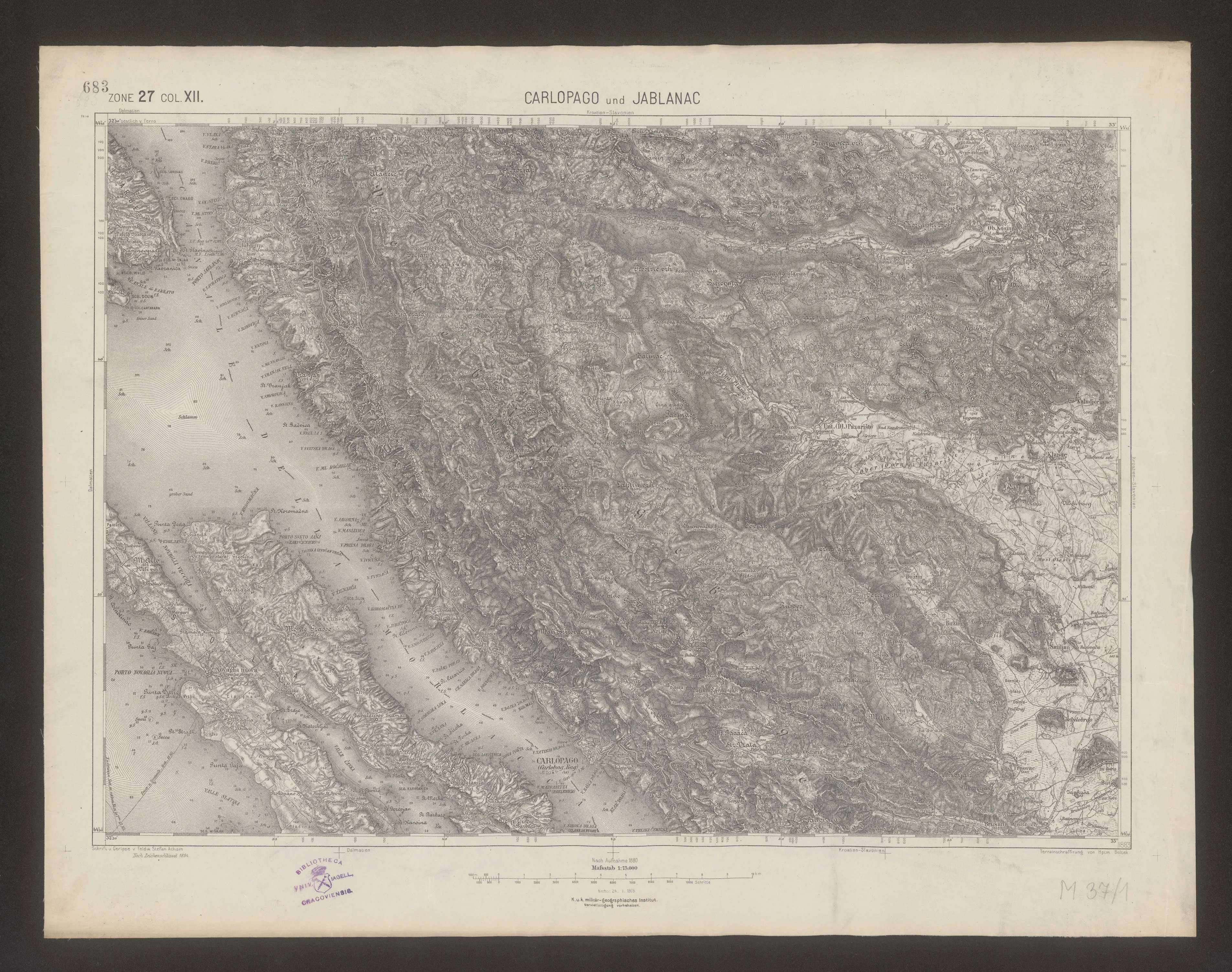
Austro-Hungarian Map of Carlopago and Jablanac (1905)
Author: Unknown
The map was created according to a survey from 1880 and updated on January 24, 1905, at the Imperial-Royal Military Geographical Institute (K. u. k. Militär-geographisches Institut).
Source: Austrian State Archives, Vienna.
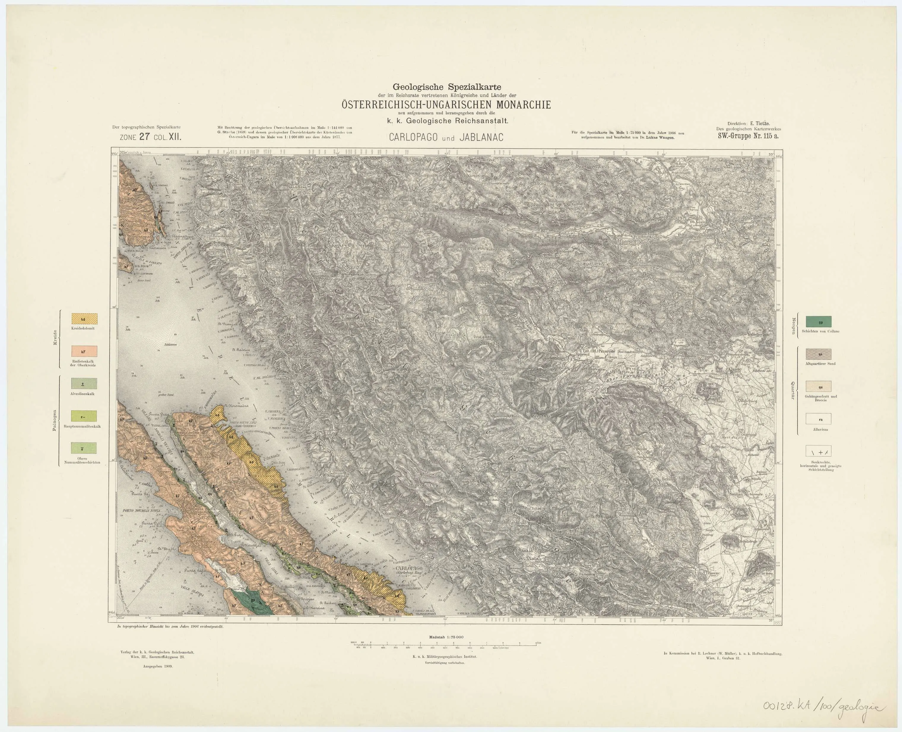
Austro-Hungarian Map of Carlopago and Jablanac (1909)
Author: Unknown
Utilizing geological overview surveys at a scale of 1:144,000 by G. Stache (1859) and his geological overview map of the Austro-Hungarian coast at a scale of 1:1,008,000 from 1877. Topographically updated until 1906. Published by the Imperial-Royal Geological Institute, Vienna, 1909.
Source: Austrian State Archives, Vienna.
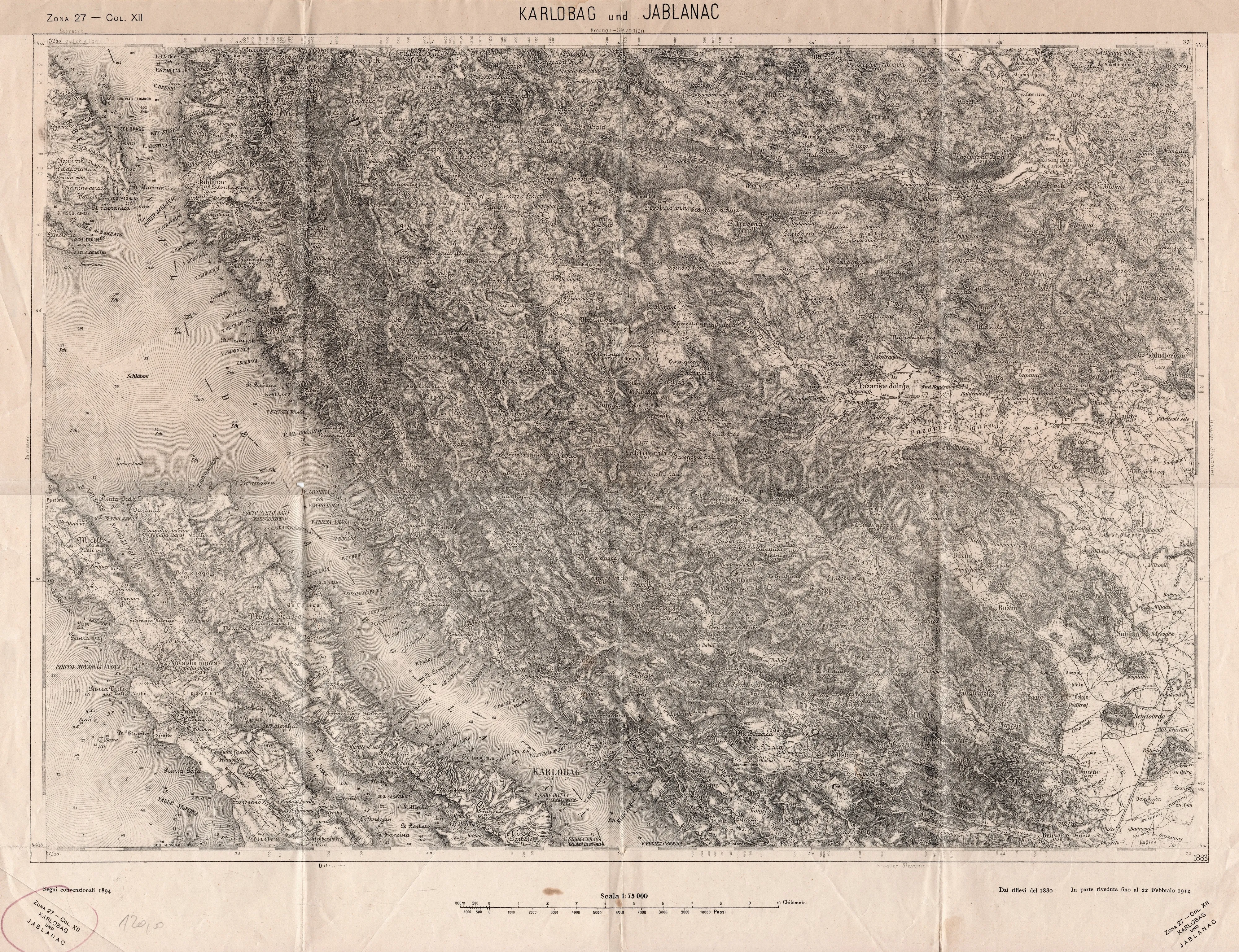
Italian map of Karlobag and Jablanac (1912)
Author: Unknown
Based on surveys from 1880. Partially revised until February 22, 1912.
Source: Private archive of Tomislav Potočnjak.
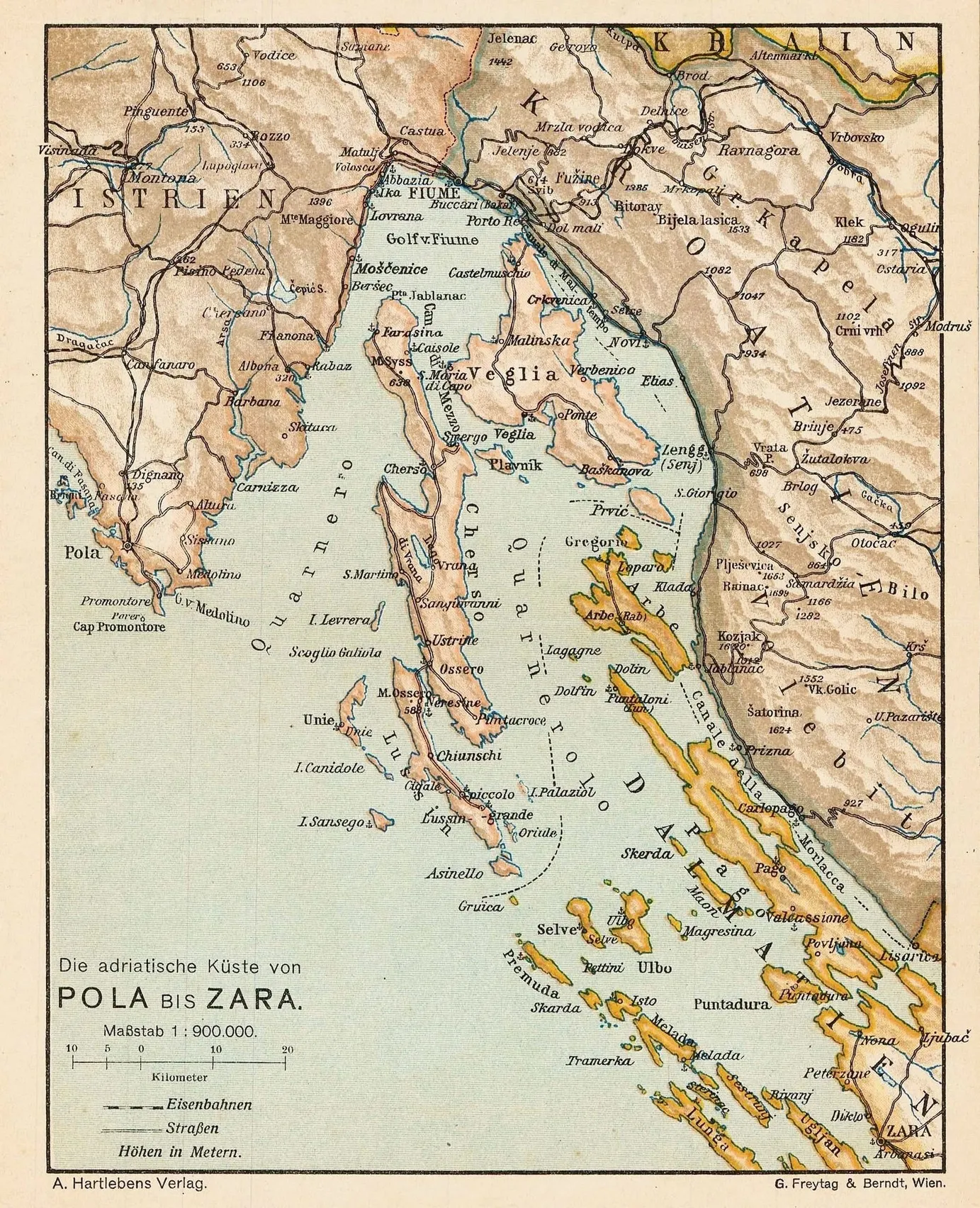
Miniature map of Croatia from Pula to Zadar (1913)
Author: Adolf Hartleben
Miniature map of Croatia from Pula to Zadar. Main roads and railway lines are marked. Printed in colour.
Source: Austrian State Archives, Vienna.
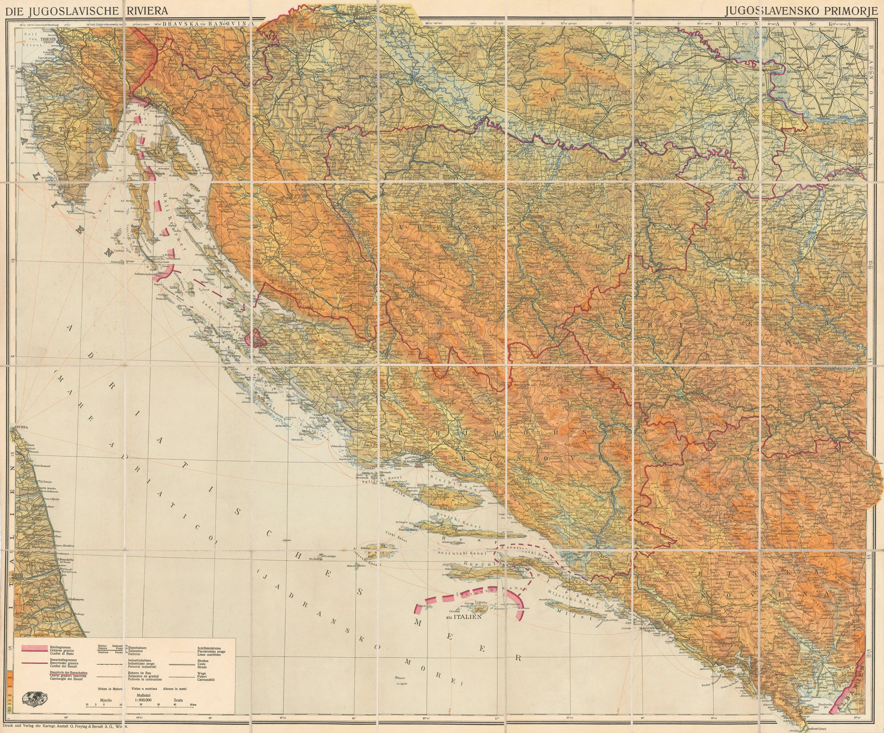
Yugoslav Riviera (Croatia and Bosnia) (1930)
Author: Freytag & Berndt
A large, folding map of Croatia and Bosnia, specifically focused on the Dalmatian coast, or the "Yugoslav Riviera," as it was known in the 1930s. Red lines indicate the boundaries of the banovinas, the new administrative divisions introduced by the Kingdom of Yugoslavia in 1929.
Source: Austrian State Archives, Vienna.
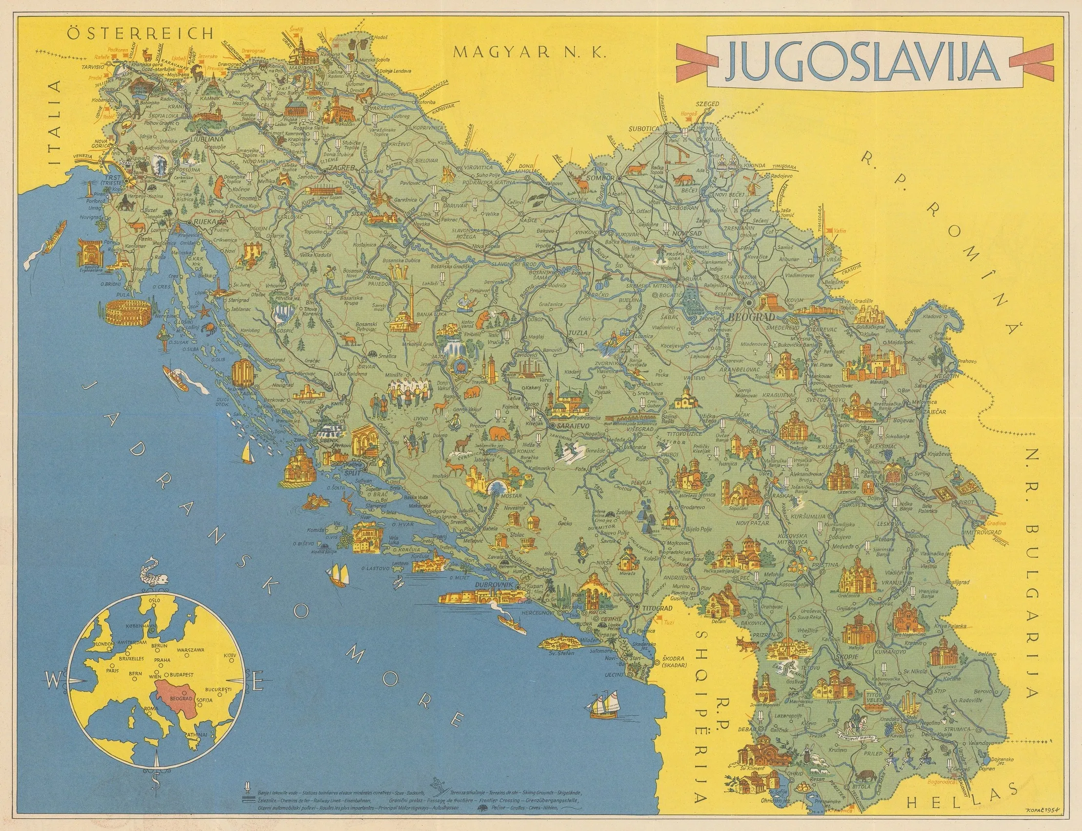
Illustrated Map of Yugoslavia (1954)
Author: Vlasto Kopač
This is an unusual, separately issued map of the state of Yugoslavia from 1954, intended for promoting tourism in Germany or Austria, as the text on the back is in German. Vlasto Kopač was a famous designer and multidisciplinary artist.
Source: Austrian State Archives, Vienna.